Mesoscale Discussion 1574
Issued: · Valid: –
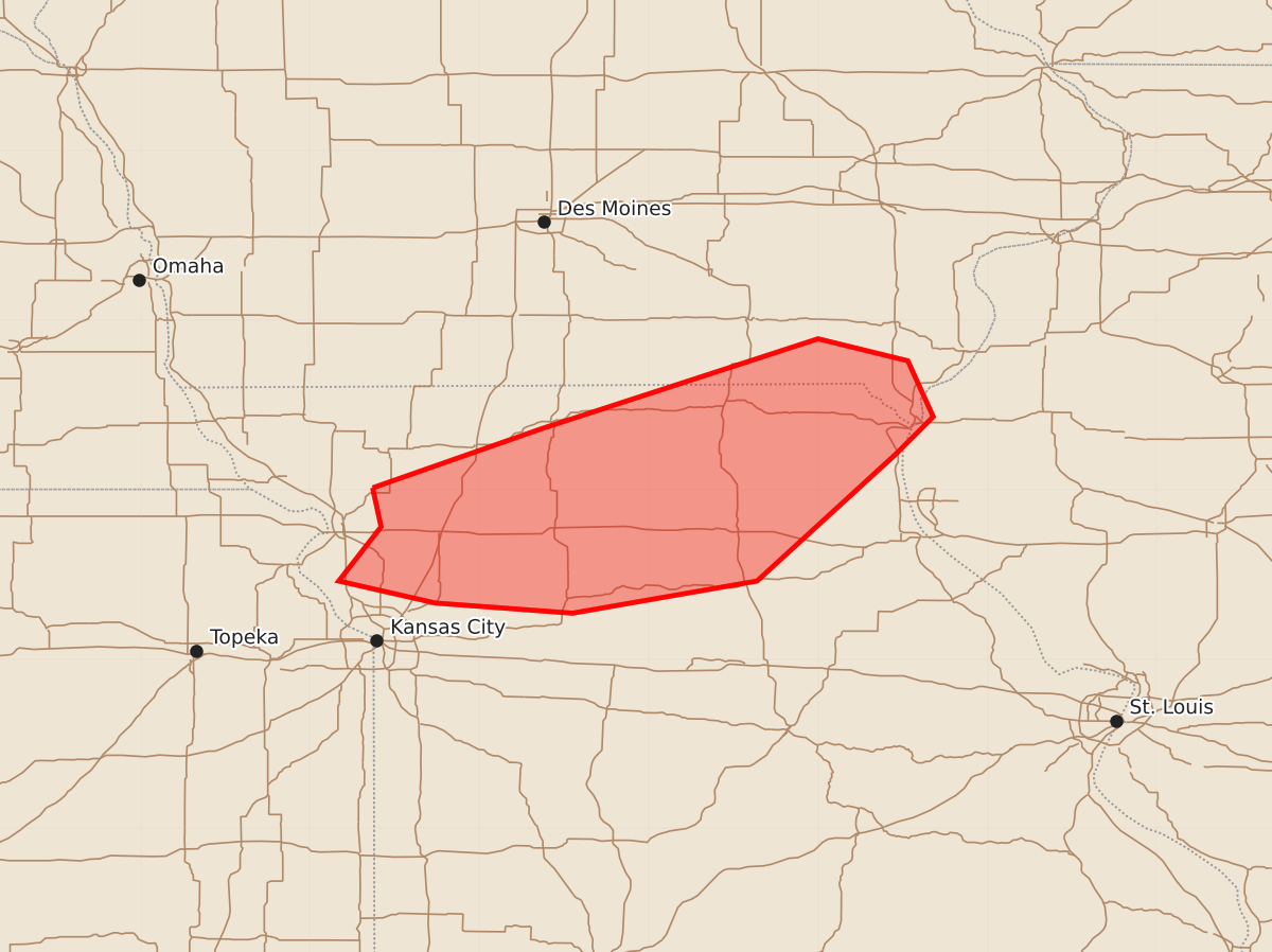
Summary
Isolated damaging wind gusts and brief hail are possible across northern Missouri and far southern Iowa from 2:17 PM to 4:15 PM CDT this Friday. These storms may produce wind gusts up to 70 mph and hail up to 1.75 inches.
Product Text
000 ACUS11 KWNS 101917 SWOMCD SPC MCD 101917 ILZ000-IAZ000-MOZ000-102115- Mesoscale Discussion 1574 NWS Storm Prediction Center Norman OK 0217 PM CDT Fri Jul 10 2026 Areas affected...northern Missouri into far southern Iowa Concerning...Severe potential...Watch possible Valid 101917Z - 102115Z Probability of Watch Issuance...40 percent SUMMARY...At least isolated damaging wind gusts or brief hail are possible across much of northern Missouri. DISCUSSION...An area of thunderstorms associated with the midlevel shortwave trough has strengthened recently as the air mass continues to destabilize. Shear is not particularly strong, but cooler profiles aloft are supporting episodic strong updrafts with brief hail cores and locally severe downbursts. A severe gust was recently reported with a collapsing storm just southwest of KSTJ. This area of storms is small, but somewhat organized with upper support. As such, some further storm strengthening is possible as gradual heating occurs out of the southwest just ahead of this system. Other additional storms may also develop ahead/northeast of this cluster toward IA within a weak warm frontal zone. ..Jewell/Smith.. 07/10/2026 ...Please see www.spc.noaa.gov for graphic product... ATTN...WFO...LSX...DVN...DMX...EAX... LAT...LON 40019463 40369363 40899200 40769147 40439132 40219154 39469236 39279345 39339426 39469483 39789458 40019463 MOST PROBABLE PEAK TORNADO INTENSITY...UP TO 90 MPH MOST PROBABLE PEAK WIND GUST...55-70 MPH MOST PROBABLE PEAK HAIL SIZE...1.00-1.75 IN