Mesoscale Discussion 2275
Issued: · Valid: –
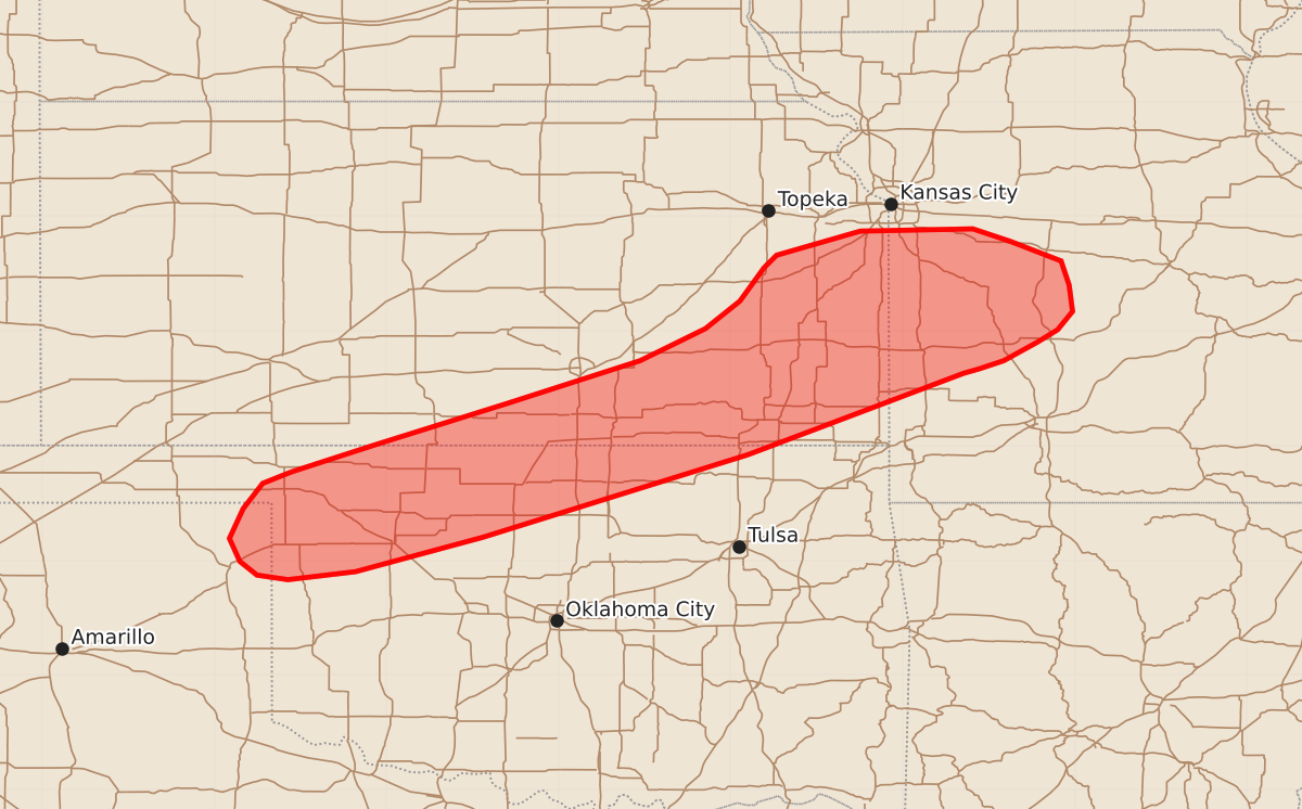
Summary
Isolated damaging wind gusts are possible through this evening across portions of the southern and central Great Plains and the Lower Missouri Valley. These severe wind gusts are expected to be infrequent and may reach speeds between 55 and 70 mph.
Product Text
000 ACUS11 KWNS 092148 SWOMCD SPC MCD 092148 MOZ000-KSZ000-OKZ000-TXZ000-092345- Mesoscale Discussion 2275 NWS Storm Prediction Center Norman OK 0448 PM CDT Wed Sep 09 2026 Areas affected...portions of the southern/central Great Plains into the Lower Missouri Valley Concerning...Severe potential...Watch unlikely Valid 092148Z - 092345Z Probability of Watch Issuance...5 percent SUMMARY...Isolated damaging/severe wind gusts will remain possible through this evening. DISCUSSION...Scattered showers and thunderstorms are ongoing along a convectively reinforced surface cold front extending from just south of Kansas City, MO, into the TX/OK Panhandles. The environment along/ahead of this boundary is characterized by 500-1500 J/kg MLCAPE and very steep low-level lapse rates (>9 C/km), with surface temperatures commonly in the low 100s F. Deep-layer flow/shear remains weak, with regional VWPs generally sampling 20-25 kts or less through the column. This should continue to promote a pulse-severe storm mode, with the potential for isolated damaging/severe wind gusts to accompany stronger downdraft (as evidenced by a recently measured 72 mph gust in the northern Texas Panhandle). The exception is across portions of west-central MO, where locally greater convective coverage is noted in closer proximity to stronger mid-level westerlies and in the vicinity of a weak surface low. Stronger effective shear (30-40 kts) coupled with marginally greater buoyancy (up to 2000 J/kg MLCAPE) may support a somewhat more well-organized cluster that would evolve eastward into west-central MO. Recent HRRR/RRFS explicit wind gust forecasts suggest some potential exists for isolated gusts up to 55-65 mph. The overall severe risk is expected to remain relatively isolated, however, precluding the need for watch issuance. ..Chalmers/Smith.. 09/09/2026 ...Please see www.spc.noaa.gov for graphic product... ATTN...WFO...SGF...EAX...TSA...TOP...ICT...OUN...DDC...AMA... LAT...LON 36779983 37009912 37379794 37749679 38029622 38269592 38559571 38669560 38879487 38899389 38789356 38619312 38409305 38179302 38019315 37909333 37749362 37679383 37639397 36929585 36209816 35909927 35839986 35870013 35990028 36190037 36450025 36670008 36779983 MOST PROBABLE PEAK WIND GUST...55-70 MPH