Mesoscale Discussion 1780
Issued: · Valid: –
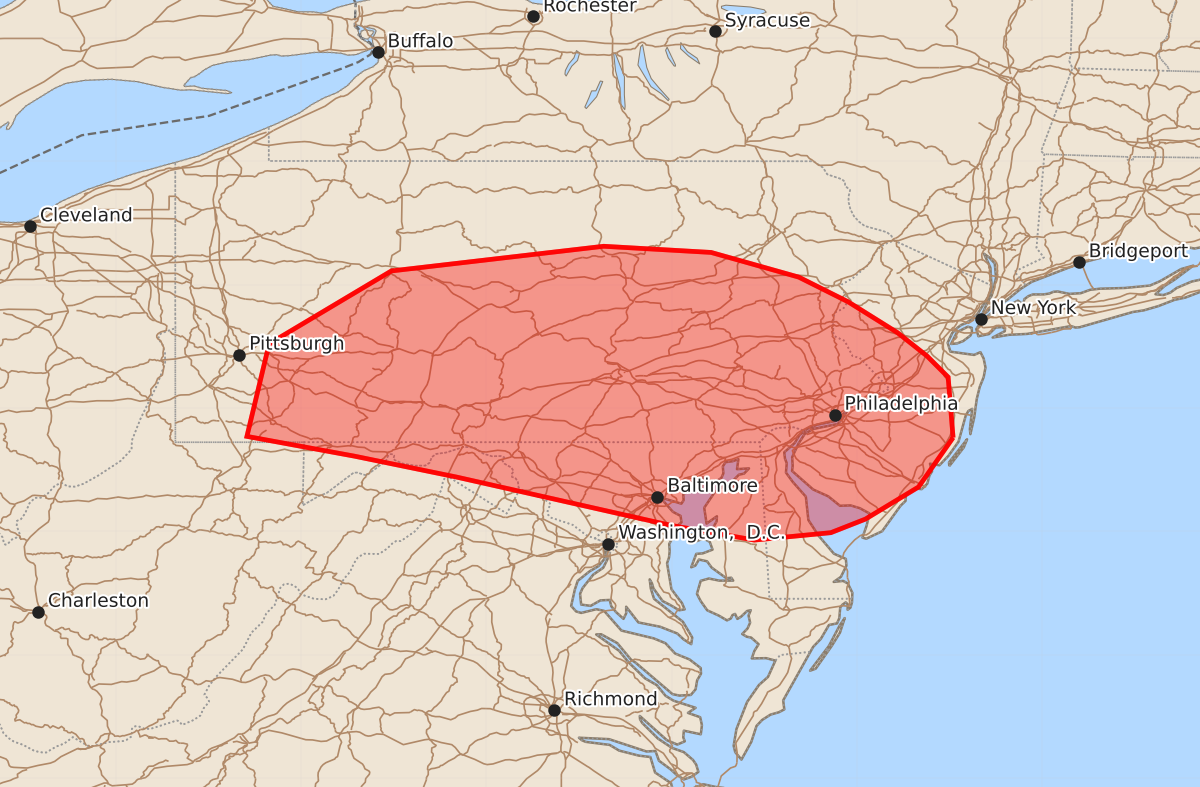
Summary
Severe thunderstorms capable of producing damaging winds and a few tornadoes are expected to increase in intensity across southern Pennsylvania, central and southern New Jersey, Delaware, and Maryland through the afternoon.
Product Text
000 ACUS11 KWNS 281609 SWOMCD SPC MCD 281608 NJZ000-PAZ000-DEZ000-MDZ000-VAZ000-WVZ000-281815- Mesoscale Discussion 1780 NWS Storm Prediction Center Norman OK 1108 AM CDT Tue Jul 28 2026 Areas affected...southern Pennsylvania...central/southern New Jersey...Delaware...Maryland Concerning...Severe potential...Watch likely Valid 281608Z - 281815Z Probability of Watch Issuance...80 percent SUMMARY...Severe potential to increase through the afternoon. DISCUSSION...Shower and thunderstorm activity is ongoing within the warm air advection zone across portions of the Mid-Atlantic into New England. Mid-level cloud cover is in place across much of the region, which is limiting heating and destabilization. Nonetheless, a few areas of more broken cloud cover has allowed for filtered heating , with temperatures in the upper 70s to 80s across portions of New Jersey and Delaware. Strengthening mid-level flow is contributing to strong deep layer shear around 30-45 kts across the region. As forcing for ascent increases and the cold front to west shifts eastward, thunderstorms are expected to increase in coverage and intensity near and ahead of the cold front. Primary risks will be damaging wind but a few transient supercells may pose potential for a tornado. ..Thornton/Hart.. 07/28/2026 ...Please see www.spc.noaa.gov for graphic product... ATTN...WFO...PHI...BGM...CTP...LWX...PBZ... LAT...LON 39767422 39367450 39107493 38997521 38937583 39027634 39057651 39447824 39617907 39777994 40527976 41117877 41317705 41267618 41067547 40867507 40617467 40427443 40257426 39767422 MOST PROBABLE PEAK TORNADO INTENSITY...UP TO 90 MPH MOST PROBABLE PEAK WIND GUST...55-70 MPH MOST PROBABLE PEAK HAIL SIZE...UP TO 1.25 IN