Mesoscale Discussion 1180
Issued: · Valid: –
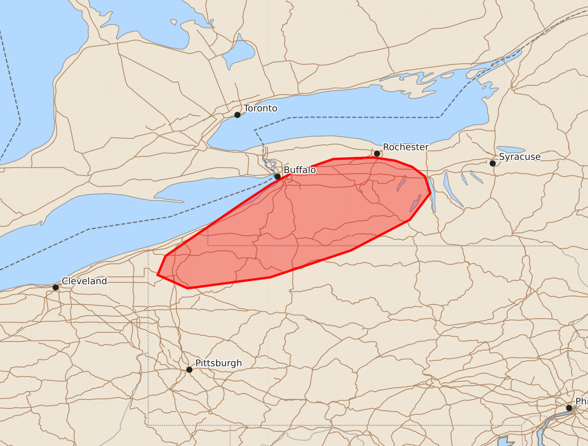
Summary
Isolated tornadoes and damaging wind gusts may occur across northwestern Pennsylvania and western New York throughout much of the morning. The expected severity for these storms is marginal.
Product Text
000 ACUS11 KWNS 181159 SWOMCD SPC MCD 181158 NYZ000-PAZ000-181400- Mesoscale Discussion 1180 NWS Storm Prediction Center Norman OK 0658 AM CDT Thu Jun 18 2026 Areas affected...Northwest Pennsylvania...Western New York Concerning...Severe potential...Watch unlikely Valid 181158Z - 181400Z Probability of Watch Issuance...20 percent SUMMARY...An isolated tornado and wind-damage threat may continue for much of the morning across parts of northwestern Pennsylvania and western New York. The threat area is expected to remain marginal, and weather watch issuance appears unlikely. DISCUSSION...A line of strong thunderstorms is currently ongoing along the eastern edge of Lake Erie, near a pocket of maximized low-level convergence. The storms are also located near a moist axis which extends northeastward from far northwestern Pennsylvania into far western New York. From near the moist axis eastward into central New York, a 50 to 60 knot low-level jet is analyzed by the RAP. In addition, the RAP shows the nose of an 80 to 100 knot mid-level jet that is moving into the central Appalachians. The two jets are greatly enhancing lift and shear across the Lower Great Lakes region. Forecast soundings this morning in far western New York have long and looped hodographs with 0-3 km storm-relative helicity above 400 m2/s2. This will support an isolated tornado threat with low-topped supercells this morning. In addition, an isolated threat for severe wind gusts will also be possible. ..Broyles/Guyer.. 06/18/2026 ...Please see www.spc.noaa.gov for graphic product... ATTN...WFO...BGM...BUF...CTP...PBZ...CLE... LAT...LON 41878030 41638040 41468002 41607897 41947795 42337720 42677694 42887701 43007717 43087739 43127766 43107817 42917872 42787896 42537934 41878030 MOST PROBABLE PEAK TORNADO INTENSITY...UP TO 90 MPH MOST PROBABLE PEAK WIND GUST...UP TO 60 MPH