Mesoscale Discussion 1726
Issued: · Valid: –
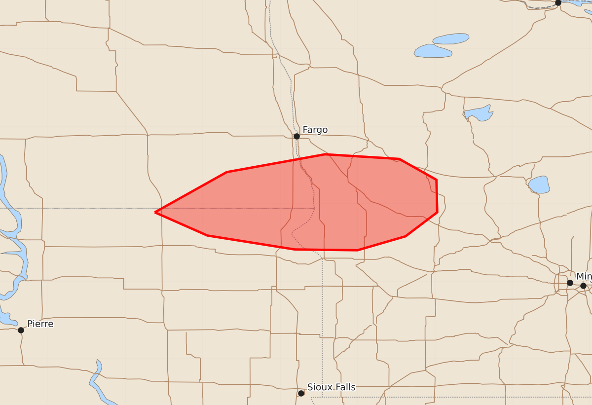
Summary
Severe thunderstorms capable of producing damaging wind gusts, hail, and possible tornadoes may affect portions of far southeastern North Dakota, far northeast South Dakota, and western Minnesota tonight. Expected hazards include wind gusts of 65 to 80 mph and hail up to 1.75 inches.
Product Text
000 ACUS11 KWNS 242350 SWOMCD SPC MCD 242349 MNZ000-SDZ000-NDZ000-250115- Mesoscale Discussion 1726 NWS Storm Prediction Center Norman OK 0649 PM CDT Fri Jul 24 2026 Areas affected...portions of far southeastern North Dakota into far northeast South Dakota and western Minnesota Concerning...Severe potential...Watch possible Valid 242349Z - 250115Z Probability of Watch Issuance...60 percent SUMMARY...An ongoing MCS may continue downstream of Severe Thunderstorm Watch 512 into far western MN. Severe gusts will be the main threat, though a couple of tornadoes or instances of severe hail are also possible. A downstream WW issuance may be needed if confidence increases in the current MCS persisting. DISCUSSION...A cold-pool-driven MCS has organized across central into southeastern ND, and should continue to propagate southeast amid a favorable deep-layer shear/buoyancy parameter space. 23Z mesoanalysis depicts over 2000 J/kg MLCAPE and 40-50 kts of effective bulk shear (aligned roughly normal to current MCS leading-line orientation) preceding the MCS downstream of the ongoing WW into far west-central MN. However, appreciable MLCINH also exists downstream, so MCS persistence is unclear. However, if MLCINH proves to be a lesser concern, an MCS may progress into MN with severe gusts, and a WW issuance would be needed. ..Squitieri/Mosier.. 07/24/2026 ...Please see www.spc.noaa.gov for graphic product... ATTN...WFO...MPX...FGF...ABR...BIS... LAT...LON 45899862 46419769 46649642 46589546 46319498 45899497 45589538 45409600 45419681 45599794 45899862 MOST PROBABLE PEAK WIND GUST...65-80 MPH MOST PROBABLE PEAK HAIL SIZE...1.00-1.75 IN