Mesoscale Discussion 1152
Issued: · Valid: –
Summary
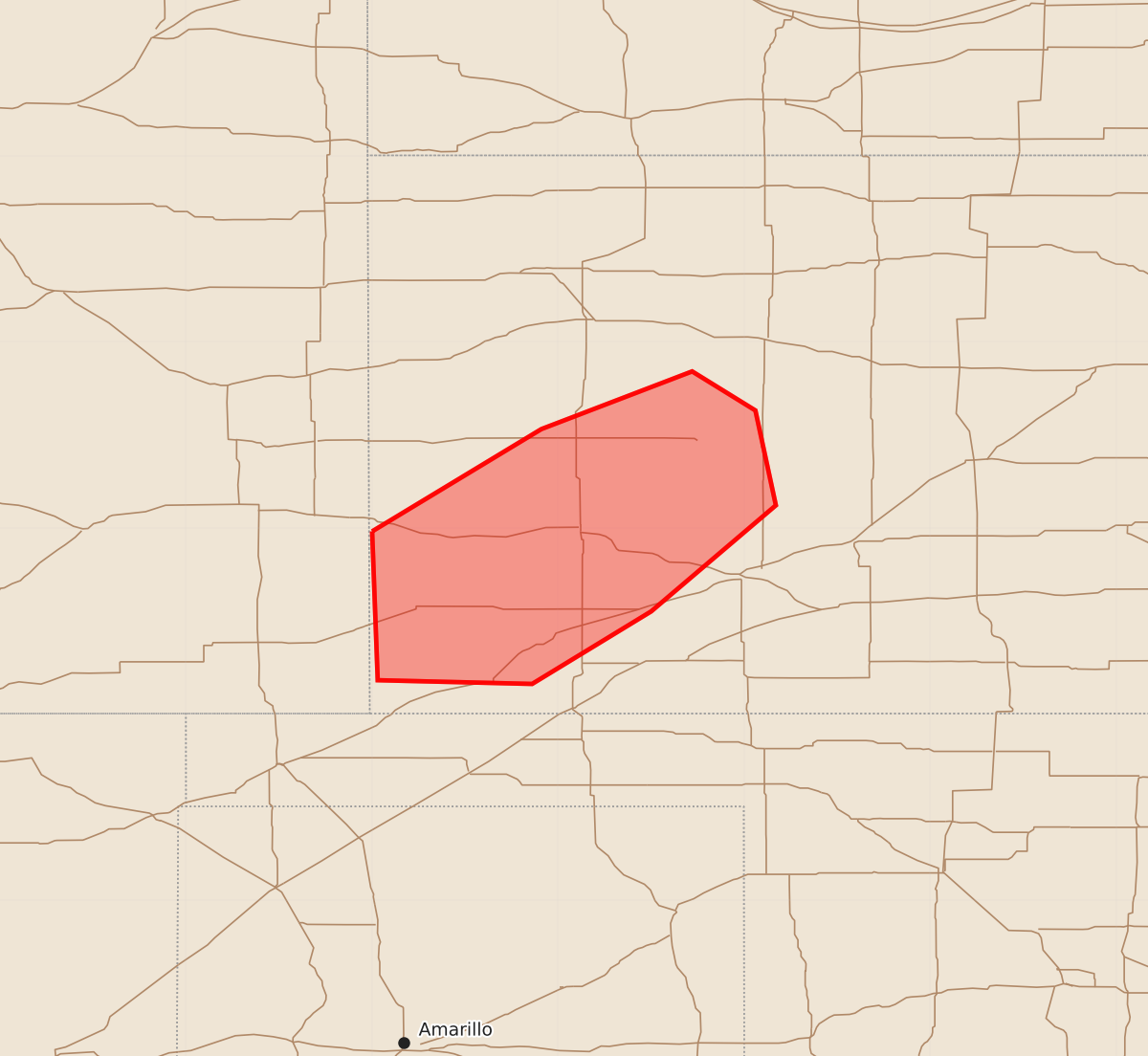
Isolated thunderstorms capable of producing large hail and gusty winds may occur across portions of western Kansas through early evening. The expected severe weather will be infrequent and scattered.
Product Text
000 ACUS11 KWNS 160441 SWOMCD SPC MCD 160440 KSZ000-160645- Mesoscale Discussion 1152 NWS Storm Prediction Center Norman OK 1140 PM CDT Mon Jun 15 2026 Areas affected...Portions of western KS Concerning...Severe potential...Watch unlikely Valid 160440Z - 160645Z Probability of Watch Issuance...5 percent SUMMARY...Isolated hail and gusty winds may occur with thunderstorms over the next couple of hours, but watch issuance is not expected. DISCUSSION...A modest strengthening of the low-level jet this evening per recent VWPs from KDDC has encouraged isolated convection to develop along/near a weak surface trough/wind shift across parts of western KS. While the 00Z DDC observed sounding showed minimal instability, a modest increase in low-level moisture has occurred over the past few hours per recent mesoanalysis estimates. This is supporting up to 1000-1500 J/kg of MUCAPE across a small portion of western KS. Around 20-30 kt of southerly low-level flow veers strongly and increases with height through mid/upper levels, which is aiding strong deep-layer shear of 40-50+ kt. One updraft has matured into a supercell across far southwest KS, and should continue to pose an isolated large hail threat in the near term. Other cells farther east may also attempt to strengthen, but weaker instability with eastward extent may tend to limit the number of stronger cells that can mature. Regardless, some hail and gusty wind threat will likely continue for the next couple of hours. But, the overall limited spatial/temporal extent of the severe threat tonight is expected to remain too isolated for watch issuance. ..Gleason.. 06/16/2026 ...Please see www.spc.noaa.gov for graphic product... ATTN...WFO...DDC...GLD... LAT...LON 37980200 38530109 38840028 38639994 38129983 37550050 37160114 37180197 37980200 MOST PROBABLE PEAK WIND GUST...UP TO 60 MPH MOST PROBABLE PEAK HAIL SIZE...1.00-1.75 IN