Mesoscale Discussion 1829
Issued: · Valid: –
Summary
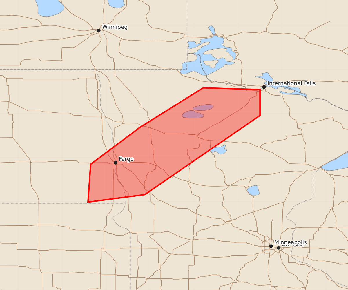
Severe thunderstorms capable of producing large hail may develop across parts of north central and west central Minnesota and southeastern North Dakota starting between 7 PM and 9 PM CDT this evening.
Product Text
000 ACUS11 KWNS 032216 SWOMCD SPC MCD 032215 MNZ000-NDZ000-040015- Mesoscale Discussion 1829 NWS Storm Prediction Center Norman OK 0515 PM CDT Mon Aug 03 2026 Areas affected...parts of north central through west central Minnesota and adjacent southeastern North Dakota Concerning...Severe potential...Watch possible Valid 032215Z - 040015Z Probability of Watch Issuance...60 percent SUMMARY...A period of strong thunderstorm development posing at least a risk for severe hail may commence by the 7-9 PM CDT time frame. DISCUSSION...A stalled, but strengthening, low-level baroclinic zone across parts of north central Minnesota through southeastern North Dakota may become a focus for thunderstorm initiation and intensification by 23-01Z. Beneath steep mid-level lapse rates associated with warm and initially capping elevated mixed layer air, latest Rapid Refresh output continues to indicate that a narrow corridor of moderate potential instability will continue to develop into early evening. Coincident with the western periphery of a 30-40 kt south-southwesterly 850 mb jet, as 50-70 kt west-southwesterly flow around 500 mb overspreads the region, the environment may become conducive to organized thunderstorm development, including supercell structures. With stronger mid/upper support for ascent generally trailing to the west of this boundary, there is some concern that stronger convection may tend to develop to the immediate cool side of the front, or become undercut fairly quickly by it. However, even if this occurs, thermodynamic profiles may still remain supportive of large hail in stronger storms for a period this evening, before the front begins to accelerate eastward in the wake of a developing frontal wave. ..Kerr/Hart.. 08/03/2026 ...Please see www.spc.noaa.gov for graphic product... ATTN...WFO...DLH...FGF... LAT...LON 48589479 48549350 47959350 46159612 45989741 46849735 47689623 48589479 MOST PROBABLE PEAK TORNADO INTENSITY...UP TO 90 MPH MOST PROBABLE PEAK WIND GUST...55-70 MPH MOST PROBABLE PEAK HAIL SIZE...1.00-1.75 IN