Mesoscale Discussion 2070
Issued: · Valid: –
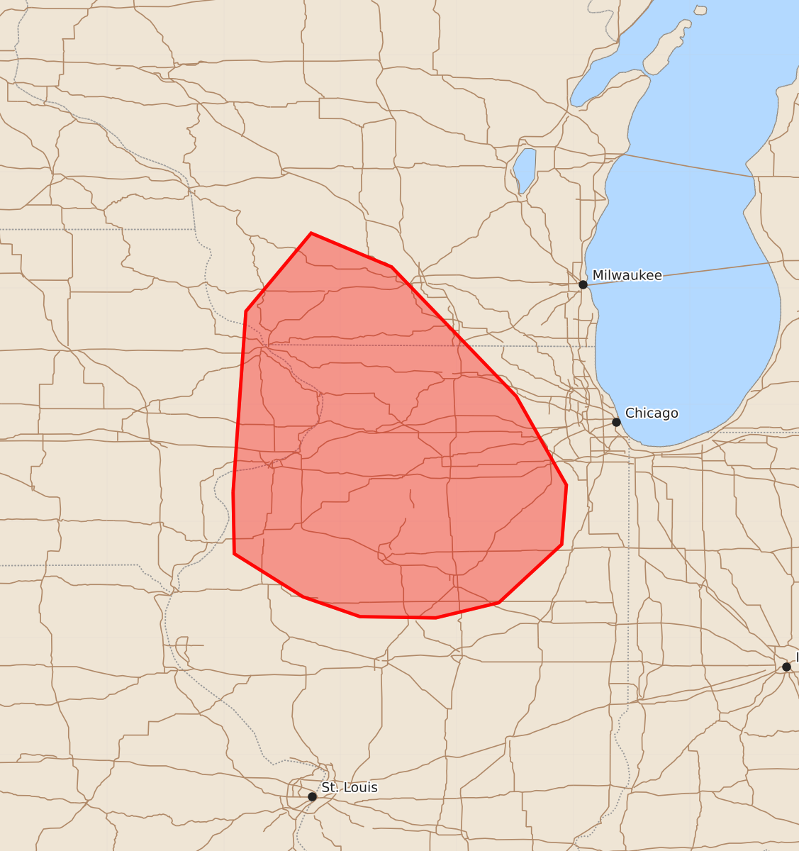
Summary
Severe thunderstorms capable of producing large hail, damaging wind gusts, and a brief tornado are expected to increase across southwest Wisconsin, far eastern Iowa, and northern Illinois through this afternoon.
Product Text
000 ACUS11 KWNS 211923 SWOMCD SPC MCD 211922 ILZ000-WIZ000-IAZ000-212115- Mesoscale Discussion 2070 NWS Storm Prediction Center Norman OK 0222 PM CDT Fri Aug 21 2026 Areas affected...southwest Wisconsin...far eastern Iowa...and northern Illinois Concerning...Severe potential...Watch likely Valid 211922Z - 212115Z Probability of Watch Issuance...80 percent SUMMARY...The threat for damaging wind gusts, large hail, and perhaps a brief tornado or two is expected to increase through the remainder of this afternoon. A severe thunderstorm watch will likely be required in the next 1-2 hours. DISCUSSION...Recent trends in visible satellite and radar data indicate incipient thunderstorm development occurring along a cold front pushing into southwest WI. Additional deepening cumulus is also noted within the pre-frontal warm sector from east-central into southeast IA. Another storm has recently intensified along the outflow boundary from earlier storms east of Rockford, IL. The 18Z DVN sounding is likely a good representation of the ambient environment with a moist profile through the lowest 3km AGL largely contributing to MLCAPE of around 2500 J/kg. Moreover, the sounding featured veering winds with height with 35-40 kt of deep-layer shear oriented largely perpendicular to the surface front. Prevailing west to west-northwest low-level winds ahead of the front may allow for air mass recovery to occur over portions of south-central WI into north-central IL later this afternoon, effectively creating a wider warm sector for the ongoing WI storms to spread southeast. The environment described above appears supportive of organized storm modes, including supercells with an attendant risk for mainly large hail initially. While low-level shear is not expected to be overly strong, some potential exists for a brief tornado or two, especially with any supercells that can favorably interact with the outflow boundary. Latest CAM guidance suggests that an initially more discrete storm mode will gradually transition to a broken band by late afternoon or this evening, at which point the threat for damaging wind gusts would increase. ..Mead/Smith.. 08/21/2026 ...Please see www.spc.noaa.gov for graphic product... ATTN...WFO...LOT...ILX...MKX...DVN...ARX... LAT...LON 41259092 42809081 43479025 43188956 42078849 41318806 40808810 40308864 40178918 40188983 40359032 40729091 41259092 MOST PROBABLE PEAK TORNADO INTENSITY...UP TO 90 MPH MOST PROBABLE PEAK WIND GUST...55-70 MPH MOST PROBABLE PEAK HAIL SIZE...1.00-1.75 IN