Mesoscale Discussion 2151
Issued: · Valid: –
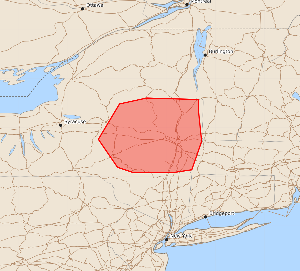
Summary
Severe thunderstorms producing damaging winds, small hail, and the potential for brief tornadoes are expected to move across central and eastern New York through late this afternoon. The primary hazard is damaging wind gusts, though marginally severe hail and an isolated tornado are possible.
Product Text
000 ACUS11 KWNS 272022 SWOMCD SPC MCD 272022 VTZ000-MAZ000-NYZ000-272215- Mesoscale Discussion 2151 NWS Storm Prediction Center Norman OK 0322 PM CDT Thu Aug 27 2026 Areas affected...portions of central and eastern NY Concerning...Severe Thunderstorm Watch 631... Valid 272022Z - 272215Z The severe weather threat for Severe Thunderstorm Watch 631 continues. SUMMARY...Through 22-23Z, the greatest severe weather threat is expected to spread east from the eastern Finger Lakes and vicinity toward the Hudson Valley/Capital District. Damaging winds will remain the primary hazard, with marginally severe hail and a brief tornado or two also possible. DISCUSSION...Despite considerable cloudiness, which has slowed more robust air mass destabilization, broken bands of semi-discrete storms have evolved over portions of central NY, with the most intense storms extending from north of Binghamton to northeast of Utica as of 2015Z. That activity is occurring within a kinematic environment featuring 30-35 kt of deep-layer shear, per current KBGM VWP. Latest model guidance suggests that storms will continue to intensify over the next 1-3 hours while progressing toward the Hudson Valley/Capital District. However, visible satellite imagery shows the presence of wave-type clouds over the Catskills, which are indicative of some degree of stability. On the condition that sufficient instability exists, locally backed surface winds and resultant stronger low-level shear evident in the KENX VWP (compared to KBGM) may support an increased supercell risk late this afternoon. Damaging wind gusts will remain the predominant hazard, though marginally severe hail and a brief tornado or two are also possible. ..Mead.. 08/27/2026 ...Please see www.spc.noaa.gov for graphic product... ATTN...WFO...BTV...ALY...BGM... LAT...LON 42767538 43487495 43607440 43577334 43307334 42727328 42147348 42087388 42087466 42197499 42767538 MOST PROBABLE PEAK TORNADO INTENSITY...UP TO 90 MPH MOST PROBABLE PEAK WIND GUST...55-70 MPH MOST PROBABLE PEAK HAIL SIZE...1.00-1.75 IN