Mesoscale Discussion 2117
Issued: · Valid: –
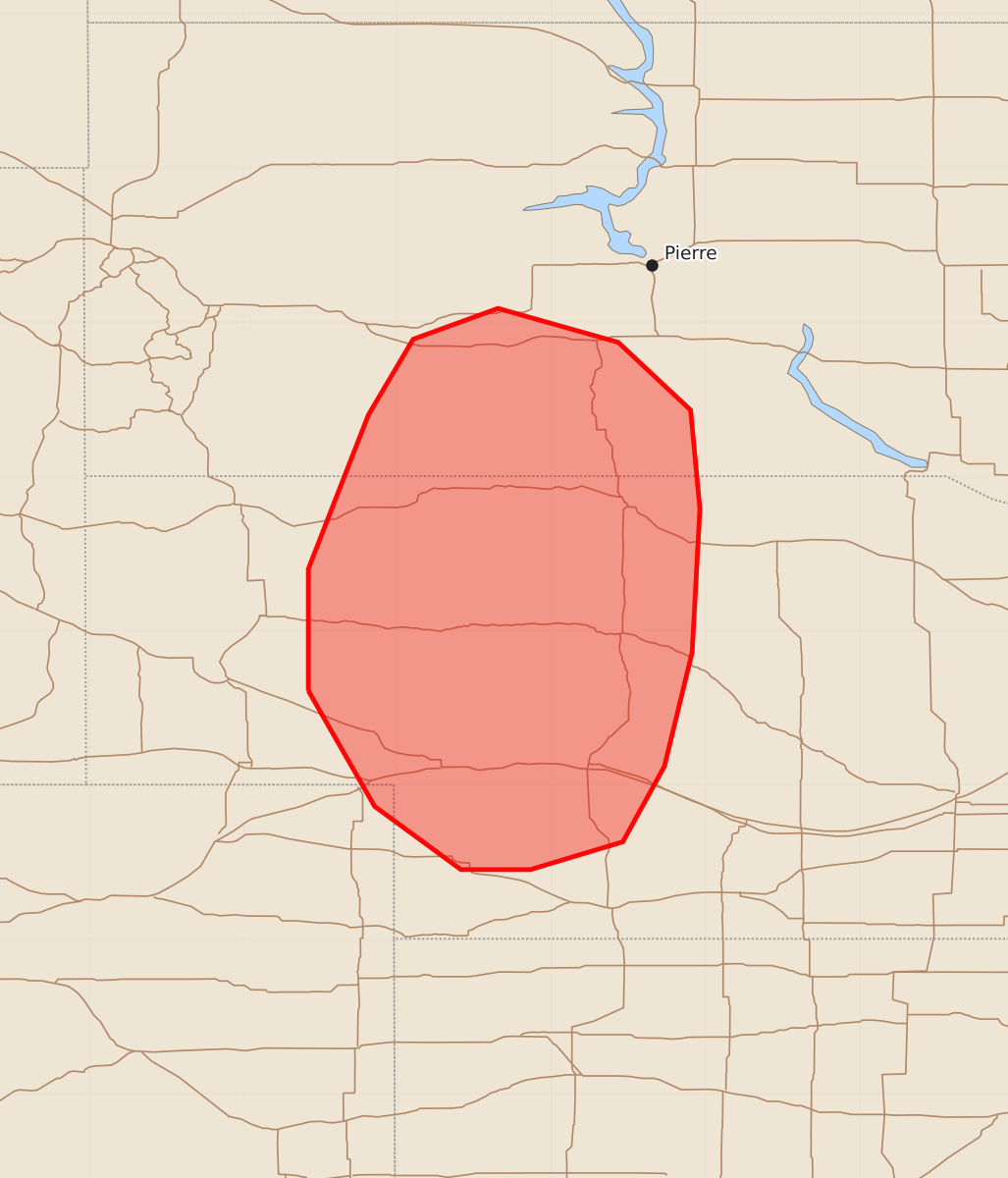
Summary
Isolated severe storms capable of producing large hail and wind gusts up to 80 mph are expected across south-central South Dakota and western Nebraska late this afternoon through this evening.
Product Text
000 ACUS11 KWNS 241940 SWOMCD SPC MCD 241940 NEZ000-SDZ000-COZ000-242215- Mesoscale Discussion 2117 NWS Storm Prediction Center Norman OK 0240 PM CDT Mon Aug 24 2026 Areas affected...south-central South Dakota into western Nebraska Concerning...Severe potential...Watch possible Valid 241940Z - 242215Z Probability of Watch Issuance...60 percent SUMMARY...The threat for at least isolated severe storms capable of severe wind gusts up to 65-80 mph and large hail potentially up to two inches is expected to increase late this afternoon through this evening. A watch is possible. DISCUSSION...Visible satellite imagery shows a growing cumulus field from Ogallala north toward Merriman in western NE, in the vicinity of a surface trough. Additional, more elevated convection is noted along the SD-NE border, near Pine Ridge. The 18Z North Platte sounding sampled the presence of an EML with considerable capping for surface-based parcels. Since that observation, surface temperatures have warmed through the 80s into lower 90s, effectively reducing the amount of convective inhibition. Forcing for ascent associated with a subtle short-wave trough currently moving through eastern WY in conjunction with continued daytime heating is expected locally erode the cap such that isolated thunderstorm development will become increasingly likely within the next 1-3 hours along the surface trough and/or cool front moving into the region from the north. The presence of steep low/mid-level lapse rates and a vertically veering wind profile with 30-35 kt of deep-layer shear will support organized storm modes, including supercells with an associated risk for large hail, potentially up to two inches and locally severe wind gusts. Latest time-lagged HRRR and RRFS guidance suggests that a more robust damaging wind threat could materialize this evening as storms merge into clusters, at which point gusts up to 65-80 mph would become more likely. ..Mead/Smith.. 08/24/2026 ...Please see www.spc.noaa.gov for graphic product... ATTN...WFO...ABR...LBF...UNR...BOU... LAT...LON 41610258 42400258 43400219 43890190 44090135 43870057 43430010 42790004 41860009 41120027 40630054 40450114 40450159 40860215 41610258 MOST PROBABLE PEAK WIND GUST...65-80 MPH MOST PROBABLE PEAK HAIL SIZE...1.50-2.50 IN