Watch 676 Outline
Issued:
Summary
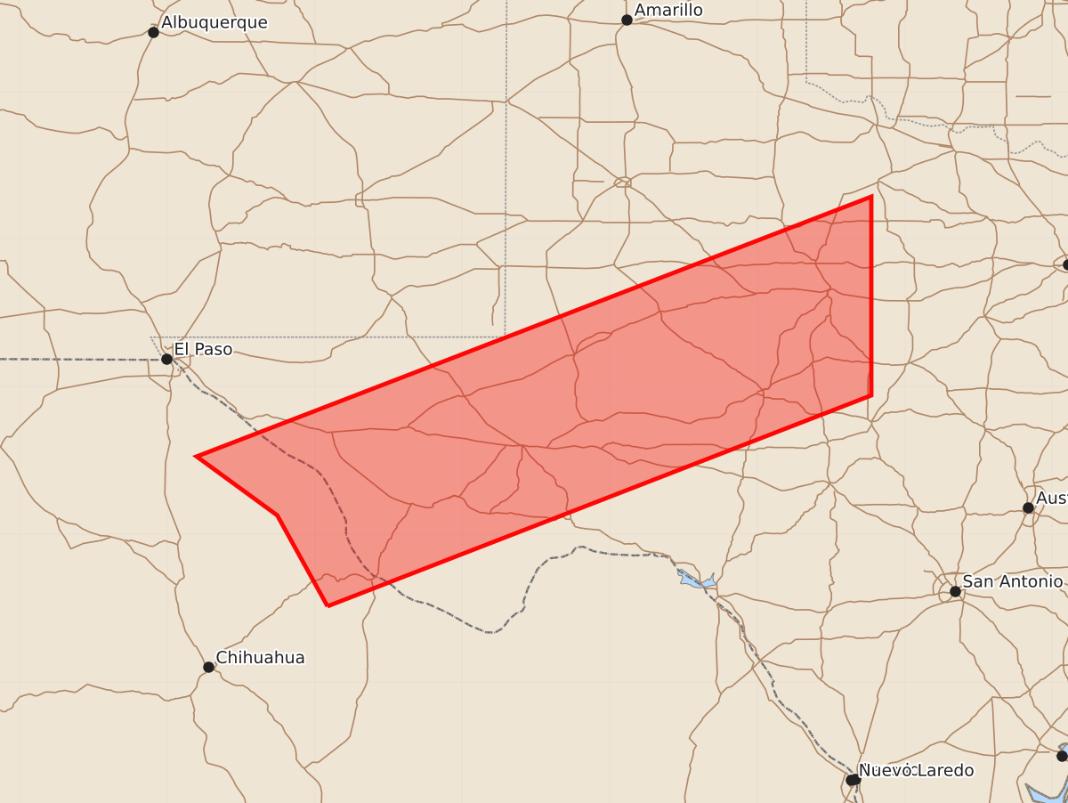
A severe thunderstorm watch is in effect for an area stretching from northwest Fort Stockton to east of Abilene, featuring the potential for 1.5-inch hail and 60-knot wind gusts through early tomorrow morning.
Product Text
000 WWUS30 KWNS 302205 SAW6 SPC AWW 302205 WW 676 SEVERE TSTM TX 302210Z - 010500Z AXIS..70 STATUTE MILES NORTH AND SOUTH OF LINE.. 10WNW FST/FORT STOCKTON TX/ - 20E ABI/ABILENE TX/ ..AVIATION COORDS.. 60NM N/S /5WNW FST - 27E ABI/ HAIL SURFACE AND ALOFT..1.5 INCHES. WIND GUSTS..60 KNOTS. MAX TOPS TO 500. MEAN STORM MOTION VECTOR 25030. LAT...LON 31990308 33439934 31419934 29960308 THIS IS AN APPROXIMATION TO THE WATCH AREA. FOR A COMPLETE DEPICTION OF THE WATCH SEE WOUS64 KWNS FOR WOU6.