Mesoscale Discussion 1177
Issued: · Valid: –
Summary
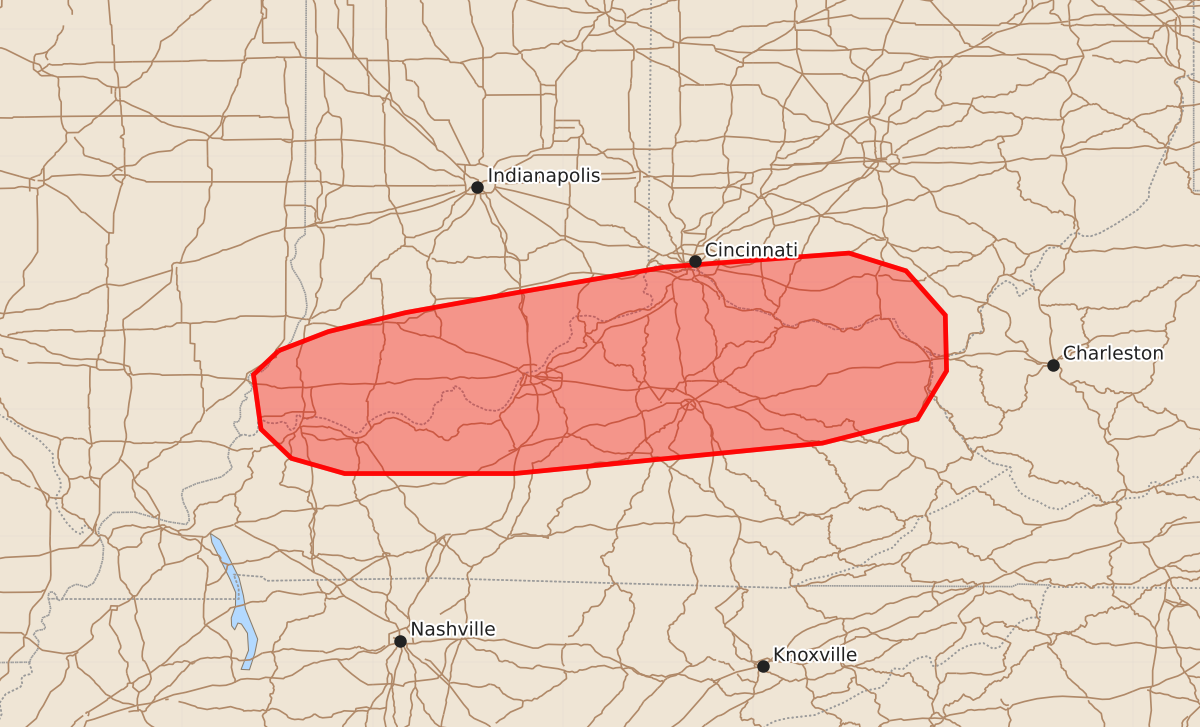
A tornado and severe wind threat continues through early morning hours for southern Indiana, far southern Ohio, and northern and central Kentucky. Expected hazards include strong tornadoes and damaging wind gusts.
Product Text
000 ACUS11 KWNS 180729 SWOMCD SPC MCD 180729 WVZ000-OHZ000-KYZ000-INZ000-ILZ000-180900- Mesoscale Discussion 1177 NWS Storm Prediction Center Norman OK 0229 AM CDT Thu Jun 18 2026 Areas affected...Southern Indiana...Far Southern Ohio...Northern and Central Kentucky Concerning...Tornado Watch 347... Valid 180729Z - 180900Z The severe weather threat for Tornado Watch 347 continues. SUMMARY...A threat for isolated severe wind gusts and a tornado risk will continue over at least the next hour or two across southern Indiana, far southern Ohio and northern/central Kentucky. A weather watch extension or replacement will likely be needed to the south of watch 347. DISCUSSION...A band of strong storms is currently ongoing along an west-southwest to east-northeast oriented zone of maximized low-level convergence, associated with an outflow boundary. From near and to the south of this boundary, moderate instability is analyzed by the RAP with MLCAPE estimated from around 1000 J/kg in northern Kentucky to near 2500 J/kg in far southern Indiana and west-central Kentucky. Over the last couple of hours, instability has increased to the south of the boundary, and this trend will likely continue. For this reason, a severe threat is expected to persist for a few more hours as the band gradually sags southeastward toward the stronger instability. Although storm mode is not particularly favorable, regional WSR-88D VWPs do show very strong low-level shear with 0-3 km storm-relative helicity exceeding 500 m2/s2. This should support a tornado threat with rotating cell elements within the band. An isolated potential for severe wind gusts is also expected, especially with bowing parts of the line. ..Broyles.. 06/18/2026 ...Please see www.spc.noaa.gov for graphic product... ATTN...WFO...RLX...JKL...ILN...LMK...IND...PAH... LAT...LON 38468774 38618735 38768674 38928585 39128469 39238324 39098279 38748248 38308247 37928270 37738345 37498588 37498722 37618764 37848788 38278794 38468774 MOST PROBABLE PEAK TORNADO INTENSITY...140-170 MPH MOST PROBABLE PEAK WIND GUST...65-80 MPH MOST PROBABLE PEAK HAIL SIZE...1.50-2.50 IN