Mesoscale Discussion 1300
Issued: · Valid: –
Summary
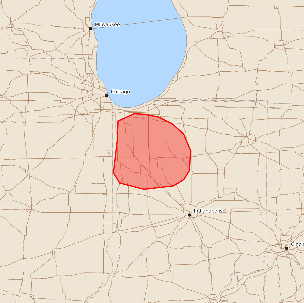
Weak severe thunderstorms with potential wind gusts up to 60 mph and hail up to 1.25 inches may affect portions of northwestern Indiana this evening.
Product Text
000 ACUS11 KWNS 242335 SWOMCD SPC MCD 242334 INZ000-250100- Mesoscale Discussion 1300 NWS Storm Prediction Center Norman OK 0634 PM CDT Wed Jun 24 2026 Areas affected...portions of northwestern Indiana Concerning...Severe potential...Watch unlikely Valid 242334Z - 250100Z Probability of Watch Issuance...20 percent SUMMARY...A downstream Severe Thunderstorm Watch appears unlikely at this time, but trends will continue to be monitored. DISCUSSION...Latest surface analysis depicts a surface temperature/thermal gradient in place across portions of northern Indiana. Despite dense cloud cover, low-level warm, moist air advection has resulted in temperatures and dewpoints rising into the mid-70s and low-60s F, respectively, south of this boundary. While latest objective analysis indicates that buoyancy remains negligible (less than 250 J/kg MLCAPE) across this area, recent high-res guidance suggests that weak destabilization may occur south of this surface boundary over the next 1-2 hours preceding the arrival of convection currently ongoing across northern/northeastern Illinois. The overall expectation is for convection to weaken as it approaches/enters northwestern Indiana owing to the aforementioned weaker buoyancy and waning diurnal cycle. Thus, downstream watch issuance appears unlikely at this time. Trends will continue to be monitored, however, as effective shear of 35-40+ kts may allow a low-end severe risk to persist into northwestern Indiana. ..Chalmers/Mosier.. 06/24/2026 ...Please see www.spc.noaa.gov for graphic product... ATTN...WFO...IWX...IND...LOT... LAT...LON 41088744 41408743 41538714 41528697 41478671 41358647 41178627 40888615 40538617 40378627 40268645 40208697 40318740 40498751 41088744 MOST PROBABLE PEAK TORNADO INTENSITY...UP TO 90 MPH MOST PROBABLE PEAK WIND GUST...UP TO 60 MPH MOST PROBABLE PEAK HAIL SIZE...UP TO 1.25 IN