Day 1 Convective Outlook
Issued: · Valid: –
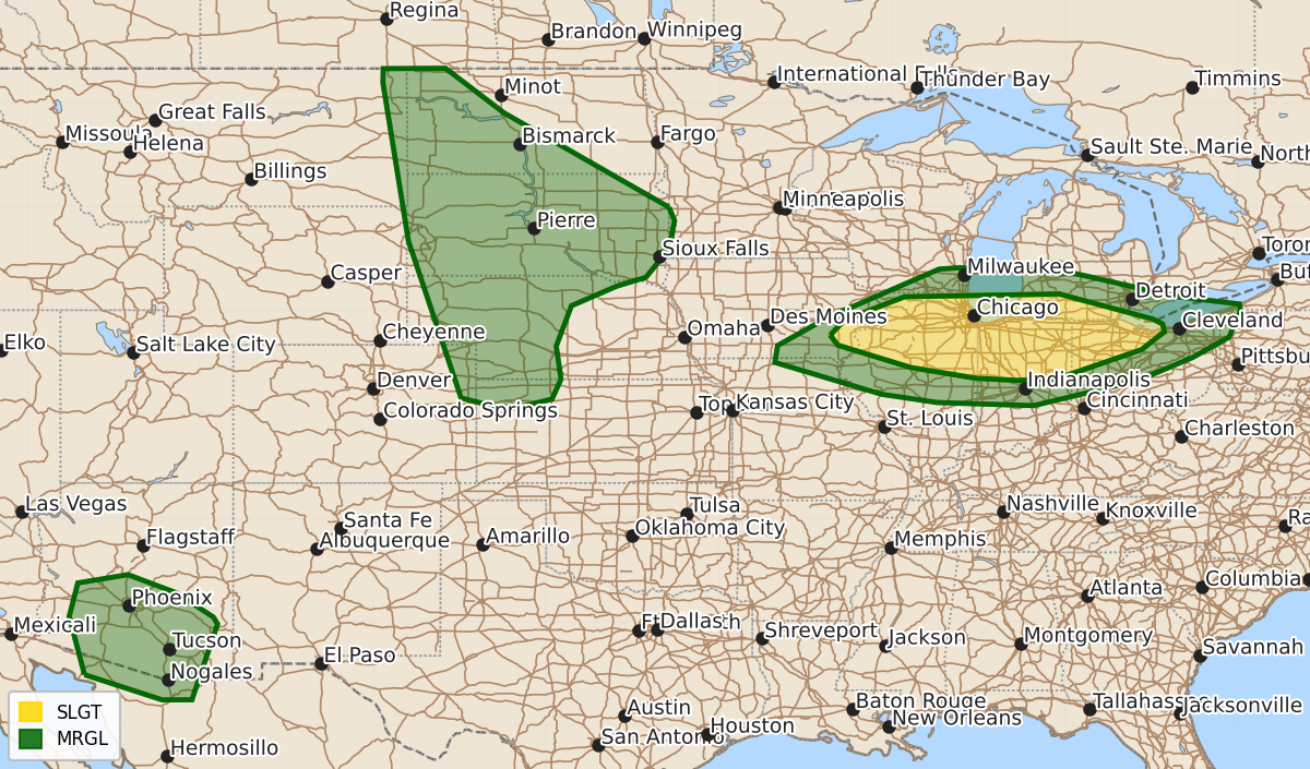
Summary
Severe thunderstorms capable of producing damaging winds and hail are expected across portions of the Midwest, the Northern and Central Plains, and Arizona from this evening through the overnight hours. The most significant threat of damaging winds will affect northern Ohio, eastern Iowa, and northern Illinois, while additional severe storms may occur across western Nebraska, the Dakotas, and Arizona.
Product Text
000 ACUS01 KWNS 100042 SWODY1 SPC AC 100041 Day 1 Convective Outlook NWS Storm Prediction Center Norman OK 0741 PM CDT Sun Aug 09 2026 Valid 100100Z - 101200Z ...THERE IS A SLIGHT RISK OF SEVERE THUNDERSTORMS ACROSS PORTIONS OF THE MIDWEST... ...SUMMARY... Severe storms are possible this evening into the overnight hours across portions of the Midwest. Damaging winds will be the main hazard with this activity. Additional strong to severe storms may occur from western Nebraska into the Dakotas, and across Arizona. ...Midwest... A bowing line of storms will continue to move east/southeast across northern OH the next few hours. Occasional damaging gusts will be possible with this activity before weakening after 04z as instability wanes across northeast OH/western PA. Model guidance continues to indicated additional convection will develop across portions of eastern IA/northern IL this evening. This activity may develop along residual outflow and a southward sagging surface front as a low-level jet increases over the next few hours. Thunderstorm clusters may grow into one or more MCSs moving east across northern IL into IN and perhaps southern Lower MI. ...Northern/Central Plains... Damaging wind and hail will be possible with convection moving across western NE this evening. As ongoing storms track east/southeast, they will encounter richer low-level moisture and increasing instability. While stronger capping persisted with eastward extent, even elevated storms will pose a severe risk as they track across WW 0549. Severe potential is less certain with northward extent across the Dakotas. Low-level moisture will increase during the evening and overnight hours, but currently, instability remains weak and capping is strong. Isolated strong cells over northeast MT will continue to develop southeast into limited instability but stronger vertical shear. If storms can be maintained and additional development occurs later this evening/overnight isolated hail and strong wind gusts will be possible. ...AZ... Similar to previous days, easterly midlevel flow will support convection moving westward off higher terrain and across the lower deserts within weak to moderate instability and steep low-level lapse rates. Strong to severe gusts will be possible with this activity. ..Leitman.. 08/10/2026 $$