Day 3 Convective Outlook
This product has been superseded. View the updated product →
Issued: · Valid: –
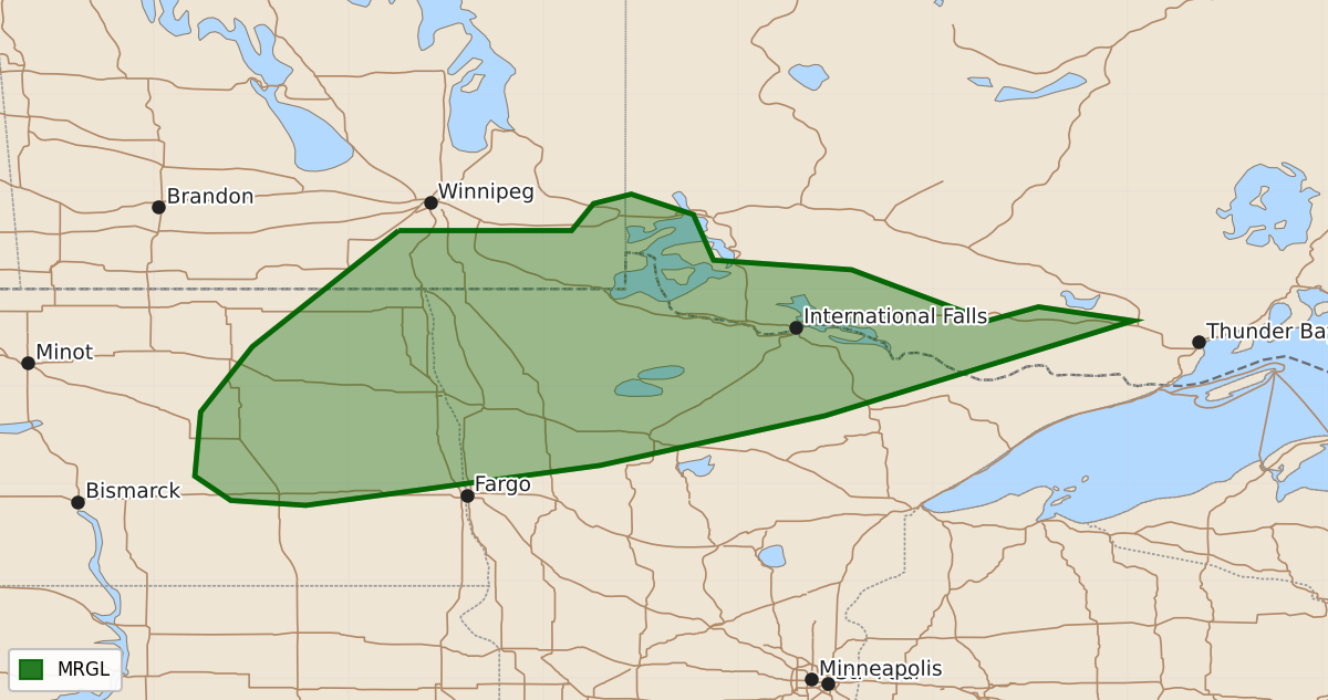
Summary
Isolated severe thunderstorms are possible across portions of eastern North Dakota and northern Minnesota on Friday. These storms may produce large hail, strong wind gusts, or tornadoes.
Product Text
000 ACUS03 KWNS 220607 SWODY3 SPC AC 220606 Day 3 Convective Outlook NWS Storm Prediction Center Norman OK 0106 AM CDT Wed Jul 22 2026 Valid 241200Z - 251200Z ...THERE IS A MARGINAL RISK OF SEVERE THUNDERSTORMS ACROSS PARTS OF EASTERN NORTH DAKOTA AND NORTHERN MINNESOTA... ...SUMMARY... Isolated severe thunderstorms are possible on Friday across portions of eastern North Dakota into northern Minnesota. ...North Dakota/Minnesota... An upper shortwave trough will develop southeast from the Canadian Prairies toward the Great Lakes on Friday. This will result in some enhancement of northwesterly flow aloft across the region. At the surface, low pressure will move from northern Manitoba into Quebec and a trailing cold front will drop southeast across ND and northern MN. Southerly low-level flow ahead of the front will transport low to mid 60s F dewpoints across parts of the eastern Dakotas and MN. A plume of steepening midlevel lapse rates will overspread the region, supporting 1000-2000 J/kg MLCAPE. Vertically veering wind profiles, with 30-50 kt northwesterly flow between 700-500 mb will support effective shear magnitudes greater than 40 kt. Isolated thunderstorms are expected to develop by late afternoon/early evening near the surface front. Wind profiles suggest supercells will be possible. Forecast soundings indicate some areas may maintain weak to moderate capping, which may preclude surface-based convection. However, elevated storms will pose a risk for isolated large hail. If thunderstorms are surface-based, a risk for strong gusts and tornado would also be possible. ..Leitman.. 07/22/2026 $$