Mesoscale Discussion 1605
Issued: · Valid: –
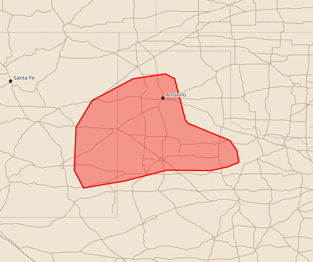
Summary
Sporadic strong wind gusts are possible across portions of eastern New Mexico and the Texas Panhandle from this afternoon into the early evening. The expected severity of these wind gusts is limited, with peak gusts potentially reaching 55 to 70 mph.
Product Text
000 ACUS11 KWNS 121927 SWOMCD SPC MCD 121927 TXZ000-NMZ000-122130- Mesoscale Discussion 1605 NWS Storm Prediction Center Norman OK 0227 PM CDT Sun Jul 12 2026 Areas affected...portions of eastern NM into the TX Panhandle/South Plains Concerning...Severe potential...Watch unlikely Valid 121927Z - 122130Z Probability of Watch Issuance...20 percent SUMMARY...Sporadic strong outflow gusts are possible this afternoon into early evening. Overall severe risk is expected to remain limited, and a watch is not currently expected. DISCUSSION...Scattered storms have gradually intensified this afternoon. Initial convection has developed within modest boundary layer moisture within an upslope flow regime. Additional thunderstorms are developing along southwestward progressing outflow from morning convection over southwest OK. Modestly steep midlevel lapse rates are supporting around 500-1500 J/kg MLCAPE, while strong heating has allow low-level lapse rates to become quite steep. Vertical shear is expected to remain weak, and combined with modest instability, should limit overall severe potential. Nevertheless, deep boundary layer mixing noted on the 18z AMA RAOB and steep 0-3 km lapse rates will support potential for strong outflow winds through early evening. ..Leitman/Smith.. 07/12/2026 ...Please see www.spc.noaa.gov for graphic product... ATTN...WFO...OUN...LUB...AMA...MAF...ABQ... LAT...LON 33499978 33370008 33270053 33280172 32990285 32800397 33280422 34440417 35160374 35750263 35880176 35750151 34630122 34540114 34080002 33809983 33499978 MOST PROBABLE PEAK WIND GUST...55-70 MPH