Mesoscale Discussion 1566
Issued: · Valid: –
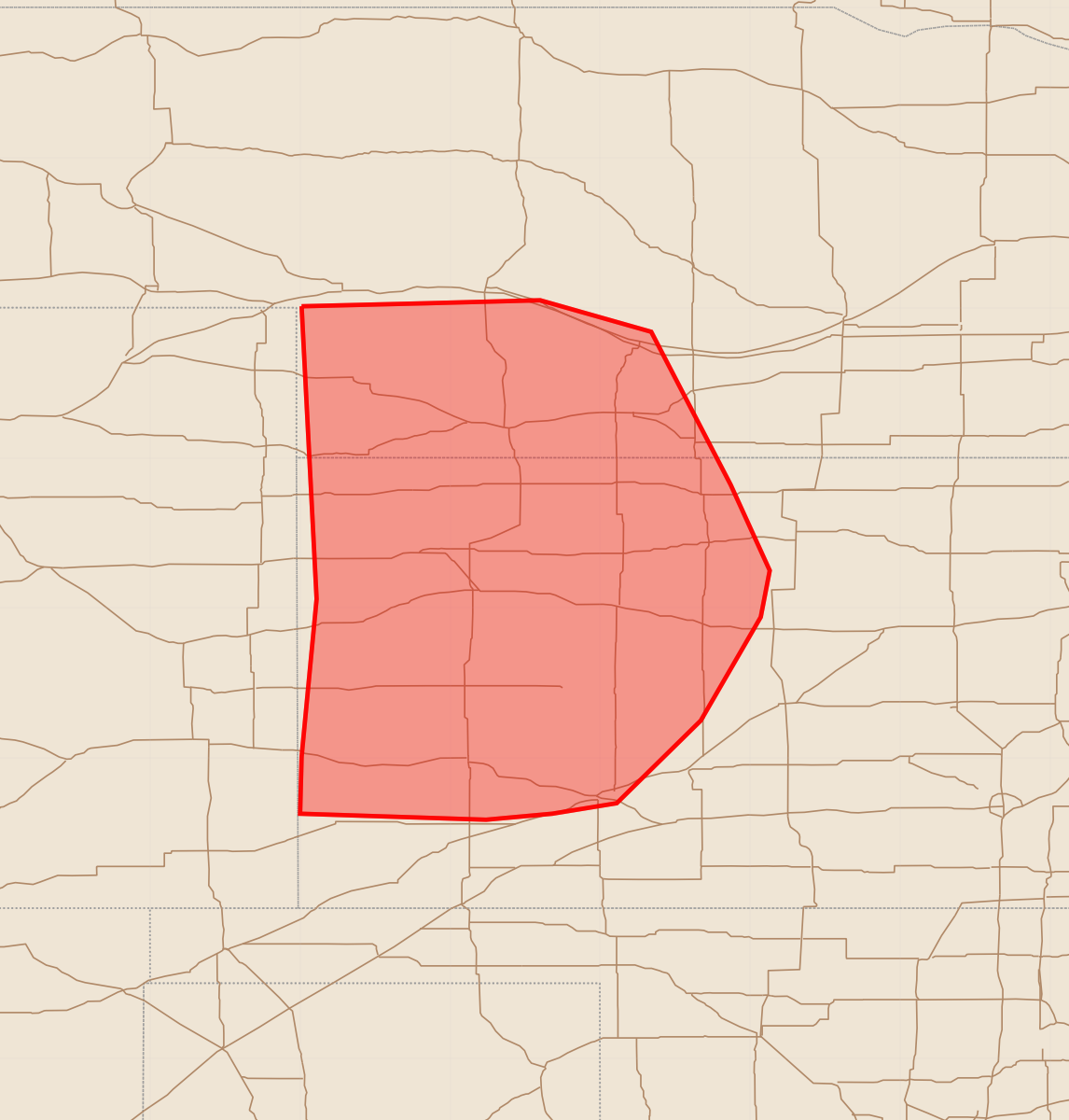
Summary
Severe thunderstorms capable of producing damaging winds and isolated hail will affect southwest Nebraska and western Kansas through the mid to late evening. Expected hazards include wind gusts potentially exceeding 75 mph and hail up to 1.75 inches.
Product Text
000 ACUS11 KWNS 100122 SWOMCD SPC MCD 100120 KSZ000-NEZ000-100245- Mesoscale Discussion 1566 NWS Storm Prediction Center Norman OK 0820 PM CDT Thu Jul 09 2026 Areas affected...southwest NE into western KS Concerning...Severe Thunderstorm Watch 475... Valid 100120Z - 100245Z The severe weather threat for Severe Thunderstorm Watch 475 continues. SUMMARY...A threat for severe wind and isolated hail may continue through mid/late evening. DISCUSSION...A loosely organized QLCS is ongoing at 0105 UTC across eastern CO, with measured gusts of 50-70 mph observed over the last hour. The downstream environment remains favorable for organized convection, with MLCAPE of near/above 1500 J/kg and moderate deep-layer shear. Some increase in MLCINH is also underway with the onset of nocturnal cooling. As a result, the longevity and organization of the ongoing convective line is somewhat uncertain into mid/late evening. However, with relatively moist low-level easterly flow and somewhat greater downstream moisture/instability in place, maintenance of the ongoing line and an eastward progression of the severe-wind threat (with localized 75+ mph gusts) appears possible into mid/late evening. Isolated hail also remains possible with any remaining semi-discrete cells. Downstream watch issuance is possible by 9 PM CDT. ..Dean/Thompson.. 07/10/2026 ...Please see www.spc.noaa.gov for graphic product... ATTN...WFO...ICT...GID...LBF...DDC...GLD... LAT...LON 41010199 41030116 41050040 40849966 39829913 39259887 38949893 38259933 37709989 37630032 37590076 37630200 38010199 39060189 41010199 MOST PROBABLE PEAK WIND GUST...65-80 MPH MOST PROBABLE PEAK HAIL SIZE...1.00-1.75 IN