Mesoscale Discussion 1333
Issued: · Valid: –
Summary
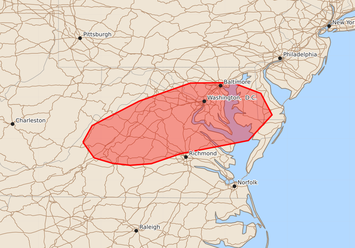
Isolated storms capable of producing damaging wind gusts up to 60 mph are expected across central Virginia and into the Delmarva peninsula this afternoon and early evening.
Product Text
000 ACUS11 KWNS 261937 SWOMCD SPC MCD 261937 DEZ000-VAZ000-MDZ000-DCZ000-WVZ000-262130- Mesoscale Discussion 1333 NWS Storm Prediction Center Norman OK 0237 PM CDT Fri Jun 26 2026 Areas affected...central Virginia into the Delmarva Concerning...Severe potential...Watch unlikely Valid 261937Z - 262130Z Probability of Watch Issuance...20 percent SUMMARY...The potential for locally damaging wind gusts is expected to increase across the discussion area this afternoon into early evening. The areal coverage and magnitude of the threat are expected to remain too limited for a watch consideration. DISCUSSION...Recent radar trends indicate gradually strengthening storms along the Blue Ridge Mountains in northern VA with additional storms noted in southeast WV. East of the high terrain, a relatively warm and moist air mass is present with steep low-level lapse rates and MLCAPE of around 1000 J/kg indicated in latest objective analyses. The presence of a westerly, deep-layer wind field should support the eastward movement of storms across the discussion area with the absence of appreciable forcing for ascent potentially limiting overall storm coverage. The KRLX and KLWX VWPs indicate 30-35 kt winds above 5 km, which are boosting vertical shear generally along and north of that latitude. That modest shear enhancement may contribute to some briefly organized storms capable of locally damaging wind gusts. Relatively warm mid-level temperatures and resultant poor lapse rates should limit large hail potential. Given the expected isolated nature of the threat, a watch is not anticipated. ..Mead/Guyer.. 06/26/2026 ...Please see www.spc.noaa.gov for graphic product... ATTN...WFO...PHI...AKQ...LWX...RNK... LAT...LON 37917993 38317971 38907858 39347734 39357633 39097564 38577537 37957594 37637758 37397828 37357879 37407922 37537966 37917993 MOST PROBABLE PEAK WIND GUST...UP TO 60 MPH