Mesoscale Discussion 1883
Issued: · Valid: –
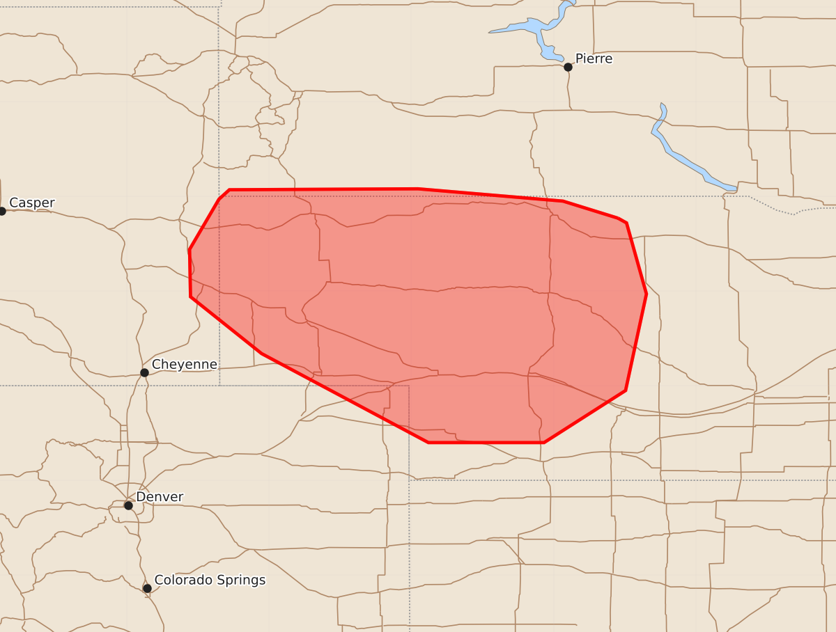
Summary
Thunderstorms with the potential for damaging winds are expected to increase across eastern Wyoming and portions of western and central Nebraska this evening. These storms could produce wind gusts between 65 and 80 mph.
Product Text
000 ACUS11 KWNS 092241 SWOMCD SPC MCD 092241 NEZ000-SDZ000-COZ000-WYZ000-100045- Mesoscale Discussion 1883 NWS Storm Prediction Center Norman OK 0541 PM CDT Sun Aug 09 2026 Areas affected...eastern Wyoming into portions of western and central Nebraska Concerning...Severe potential...Watch possible Valid 092241Z - 100045Z Probability of Watch Issuance...40 percent SUMMARY...Thunderstorms to increase in coverage and spread westward this evening with potential for damaging winds. DISCUSSION...Thunderstorm development is increasing across potions of eastern Wyoming into western Nebraska over the last hour. The 18z RAOB from LBF shows stout MLCIN in place, which is still depicted by SPC mesoanalysis. However, with daytime heating CIN has weakened across the Nebraska Panhandle where temperatures are in the mid to upper 90s. Dew points in the 40s-50s F are contributing to large temperature/dew point spreads across the Nebraska Panhandle. Steep low to mid-level lapse rates are also noted across the region. Guidance is inconsistent with the evolution of storms out of Wyoming, with some favoring a more organized cluster with damaging wind potential and others favoring a weakening cluster with eastward propagation. This leads to low confidence in evolution and watch potential at this time. Should a cluster evolve, damaging wind potential (perhaps 75+ mph) would increase downstream. Trends will be monitored and a watch may be possible. ..Thornton/Mosier.. 08/09/2026 ...Please see www.spc.noaa.gov for graphic product... ATTN...WFO...GID...LBF...UNR...BOU...CYS... LAT...LON 42779982 42950040 43080193 43070392 42970403 42440434 41940433 41340358 40400182 40400060 40959974 41979952 42729973 42779982 MOST PROBABLE PEAK WIND GUST...65-80 MPH MOST PROBABLE PEAK HAIL SIZE...UP TO 1.25 IN