Mesoscale Discussion 1014
Issued: · Valid: –
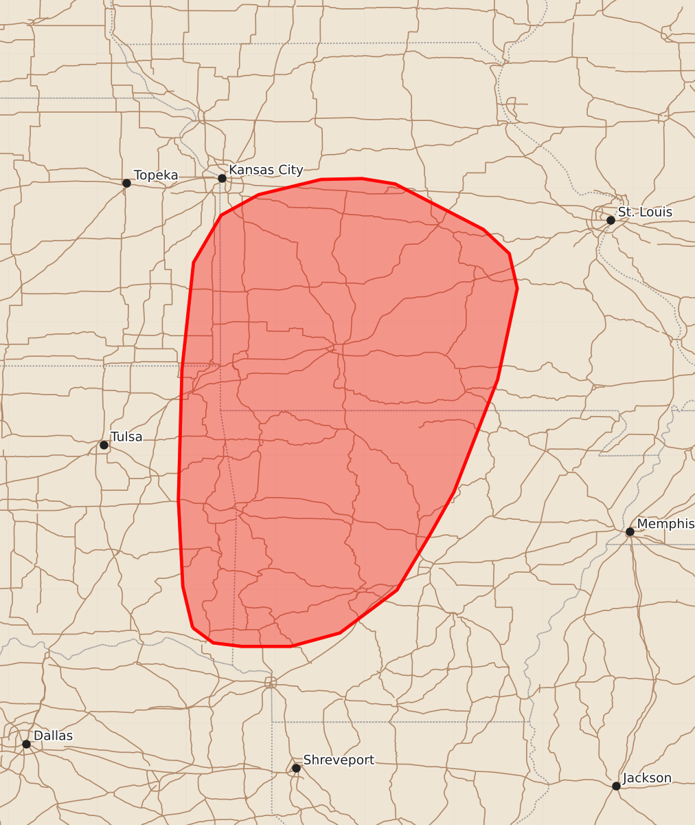
Summary
Scattered to numerous thunderstorms are expected this afternoon across portions of the Ozarks and ArkLaTex, bringing the potential for a couple of tornadoes and isolated damaging wind gusts. These severe weather conditions are expected to affect the region from the Ozarks southward into the Ouachita Mountains and ArkLaTex through the afternoon.
Product Text
000 ACUS11 KWNS 071817 SWOMCD SPC MCD 071816 MOZ000-ARZ000-OKZ000-KSZ000-072015- Mesoscale Discussion 1014 NWS Storm Prediction Center Norman OK 0116 PM CDT Sun Jun 07 2026 Areas affected...portions of the Ozarks and ArkLaTex Concerning...Severe potential...Watch possible Valid 071816Z - 072015Z Probability of Watch Issuance...40 percent SUMMARY...Scattered to numerous thunderstorms are expected this afternoon from the Ozarks southward into the Ouachita Mountains and ArkLaTex. A couple of tornadoes and isolated damaging winds gusts are possible. Trends will be monitored for the potential issuance of a targeted Tornado Watch for a portion of the discussion area. DISCUSSION...Continued heating of a very moist low-level air mass is supporting an increase in thunderstorm coverage across portions of the Ozarks southward into ArkLaTex as of early this afternoon ahead of an MCV evident near Tulsa, OK, in latest satellite/radar imagery. An associated band of 30-40+ kt southwesterly mid-level flow is located downstream of this MCV, with around 40-45 kt recently sampled around 4 km AGL by the SRX/SGF VAD profiles. This will continue to contribute to a modest enlargement of low-level hodographs, with around 100 m2/s2 0-1 km SRH expected by mid-afternoon. This will promote the potential for weak supercells and a couple of tornadoes, with the greatest potential expected across southwestern Missouri and northwestern Arkansas where locally backed surface flow yield a further enhancement to low-level hodographs (around 70-75 0-1 km SRH recently sampled by the SGF VAD). Rich moisture (PWATs of 1.75-2.0+ inches, as sampled by regional 12z observed soundings) may also support occasional water-loaded downbursts and isolated damaging wind gusts. Convective trends will continue to be monitored, and a targeted Tornado Watch may be considered for a portion of the discussion area. ..Chalmers/Smith.. 06/07/2026 ...Please see www.spc.noaa.gov for graphic product... ATTN...WFO...LSX...LZK...SGF...SHV...EAX...TSA... LAT...LON 34079493 34539504 35509509 36969505 38169492 38699461 38929419 39099349 39109303 39049266 38539167 38269138 37879129 36859151 35599200 35119227 34499264 34019328 33869383 33869438 33909470 34079493 MOST PROBABLE PEAK TORNADO INTENSITY...85-110 MPH MOST PROBABLE PEAK WIND GUST...UP TO 60 MPH