Day 1 Convective Outlook
Issued: · Valid: –
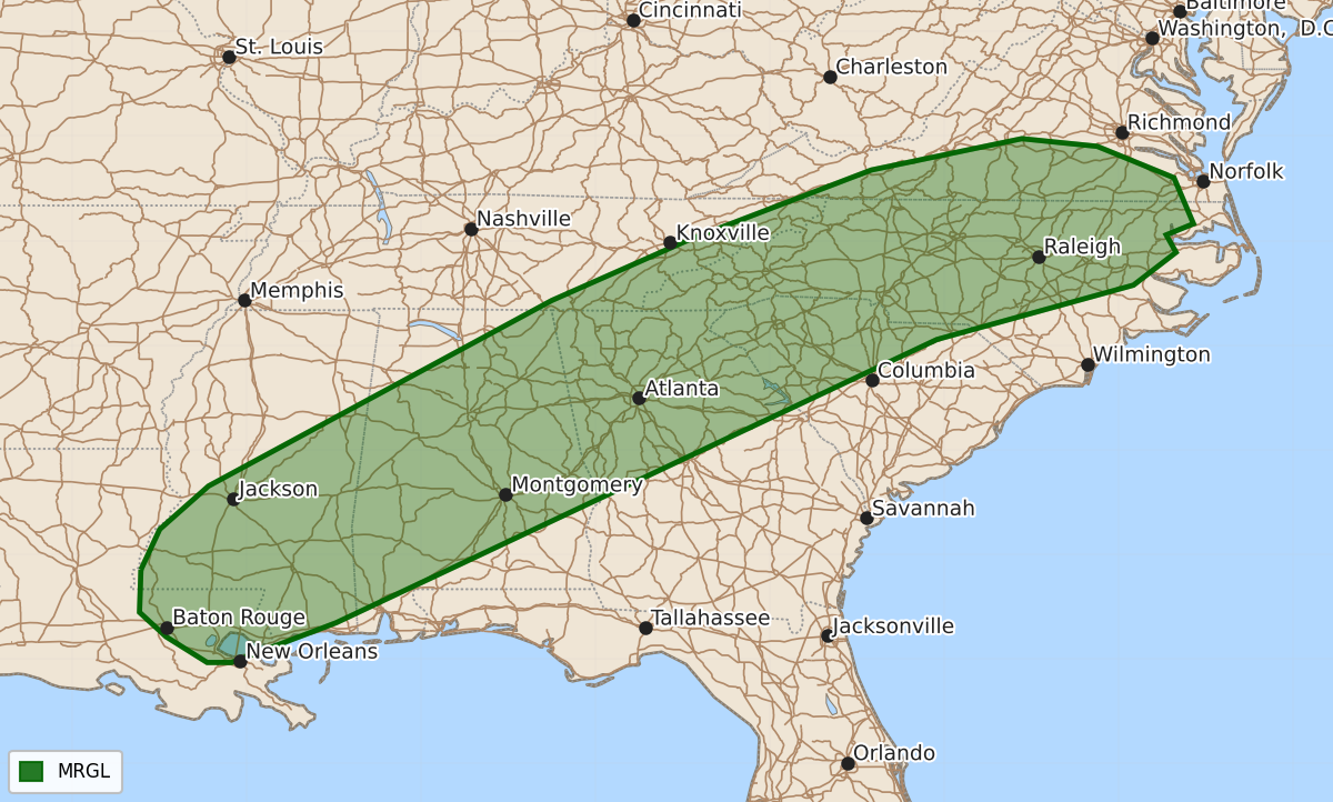
Summary
Isolated severe wind gusts are possible early this evening across parts of the Southeast, the southern Appalachians, and the southern Mid-Atlantic.
Product Text
000 ACUS01 KWNS 220043 SWODY1 SPC AC 220042 Day 1 Convective Outlook NWS Storm Prediction Center Norman OK 0742 PM CDT Mon Sep 21 2026 Valid 220100Z - 221200Z ...THERE IS A MARGINAL RISK OF SEVERE THUNDERSTORMS FROM PARTS OF THE SOUTHEAST TO THE SOUTHERN MID-ATLANTIC... ...SUMMARY... Isolated severe wind gusts will be possible early this evening from parts of the Southeast into the southern Appalachians and southern Mid-Atlantic. ...Southeast/Southern Appalachians/Southern Mid-Atlantic... At the surface, a diffuse and slow moving cold front is currently analyzed from northern Mississippi northeastward to West Virginia. To the southeast of the front, a moist airmass is in place with dewpoints mostly from the mid 60s to the mid 70s F. In response to surface heating, moderate instability has developed over much of this moist airmass. Along this southwest-to-northeast corridor, MLCAPE is estimated by the RAP to be in the 1500 to 2500 J/kg range. Although deep-layer shear is limited, the instability could support a potential for isolated severe wind gusts over the next hour or two, while low-level lapse rates remain steep. ..Broyles.. 09/22/2026 $$