Mesoscale Discussion 2342
Issued: · Valid: –
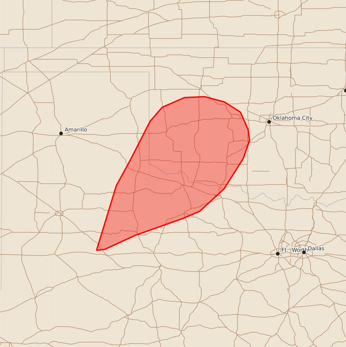
Summary
Increasing storm coverage may produce strong wind gusts in northwest Texas and western Oklahoma through early tonight. Severe wind gusts of up to 60 mph are possible.
Product Text
000 ACUS11 KWNS 010102 SWOMCD SPC MCD 010102 OKZ000-TXZ000-010400- Mesoscale Discussion 2342 NWS Storm Prediction Center Norman OK 0802 PM CDT Wed Sep 30 2026 Areas affected...northwest Texas into western Oklahoma Concerning...Severe potential...Watch unlikely Valid 010102Z - 010400Z Probability of Watch Issuance...20 percent SUMMARY...Storms are likely to increase in coverage, and a few strong to locally severe gusts cannot be ruled out. DISCUSSION...A cold front is currently moving into the eastern TX Panhandle and South Plains, with increasing storm development both along and ahead of it. The air mass is marginally unstable, with MLCAPE around 1000 J/kg and high precipitable water over 2.00". Deep-layer wind fields are mostly parallel to the front and out of the southwest, which is not favorable for supercells. However, this could favor northeastward-moving storms/clusters with gusty winds. Hobart OK recently measured a gust of 40 mph, and other stations east of Lubbock indicating 45-50 mph. Low-level shear remains marginally favorable for rotation, with 0-1 SRH of 100-150 m2/s2 over OK and northern TX. Storms trends will continue to be monitored for any uptick in severe potential this evening, but a watch is not currently anticipated. ..Jewell/Hart.. 10/01/2026 ...Please see www.spc.noaa.gov for graphic product... ATTN...WFO...OUN...SJT...LUB...AMA...MAF... LAT...LON 32810109 34150068 34660040 35489998 35779973 35979927 35999885 35889844 35679811 35319795 35099792 34719805 34089845 33629895 33479930 33120029 32830092 32810109 MOST PROBABLE PEAK TORNADO INTENSITY...UP TO 90 MPH MOST PROBABLE PEAK WIND GUST...UP TO 60 MPH