Mesoscale Discussion 1162
This product has been superseded. View the updated product →
Issued: · Valid: –
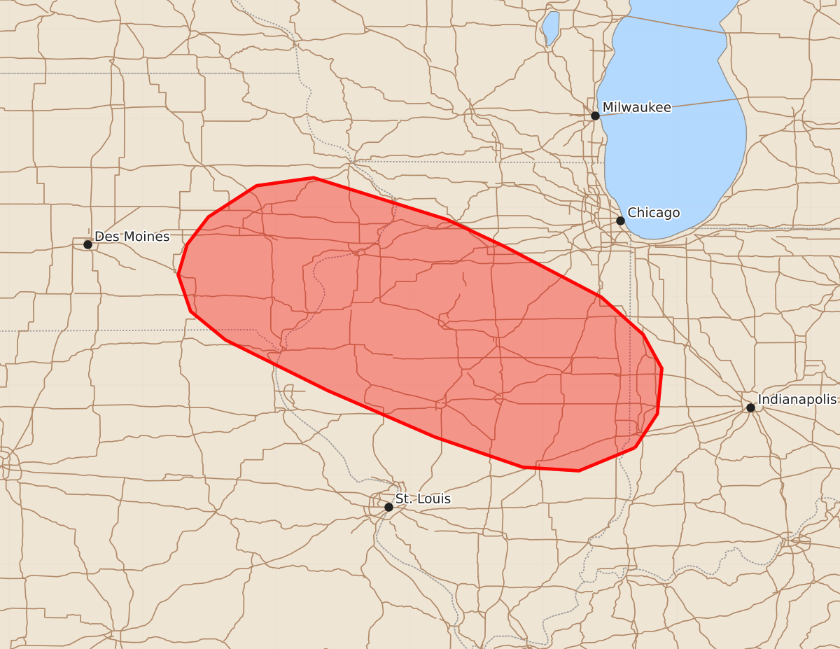
Summary
Severe thunderstorms capable of producing tornadoes, large hail, and wind gusts exceeding 80 mph are expected across eastern Iowa, central and northern Illinois, far western Indiana, and far northeast Missouri this morning. These intense storms will move quickly southeastward through the region during the morning hours.
Product Text
000 ACUS11 KWNS 171222 SWOMCD SPC MCD 171221 INZ000-ILZ000-IAZ000-MOZ000-171415- Mesoscale Discussion 1162 NWS Storm Prediction Center Norman OK 0721 AM CDT Wed Jun 17 2026 Areas affected...Eastern Iowa...Far Northeast Missouri...Central and Northern Illinois...Far Western Indiana Concerning...Severe potential...Watch likely Valid 171221Z - 171415Z Probability of Watch Issuance...95 percent SUMMARY...Severe wind gusts potentially above 80 mph, tornadoes and isolated large hail will be likely this morning from eastern Iowa southeastward across northwest and and central Illinois. Weather watch issuance is expected along this corridor. DISCUSSION...Radar imagery shows a well-developed severe bowing line segment ongoing over eastern Iowa. This line will move quickly southeastward into northwestern and central Illinois this morning, where damaging wind gusts will be likely. The line is located near the nose of a strong low-level jet, which will shift eastward into western Illinois over the next few hours. In response, the bowing line segment is expected to become very organized and will lay down a swath of wind-damage across northwest and central Illinois, where wind gusts in the 80 to 100 mph range will be possible. In addition, RAP forecast soundings increase 0-3 km storm-relative helicity into the 400 to 450 m2/s2 range across western and central Illinois by mid morning, suggesting that a tornado threat will develop with the bowing line segment. Tornadoes will be possible near the apex of the bow, and with any supercell embedded in the line. Isolated large to very hail could also occur within the more intense cores of supercells. ..Broyles/Guyer.. 06/17/2026 ...Please see www.spc.noaa.gov for graphic product... ATTN...WFO...IND...LOT...ILX...LSX...DVN...DMX... LAT...LON 39308747 39048810 39088873 39428972 39949092 40519207 40839246 41249260 41589250 41899226 42249172 42339108 41868958 41568894 40998785 40578738 40198717 39688722 39308747 MOST PROBABLE PEAK TORNADO INTENSITY...140-170 MPH MOST PROBABLE PEAK WIND GUST...65-80 MPH MOST PROBABLE PEAK HAIL SIZE...2.00-3.50 IN