Mesoscale Discussion 1397
Issued: · Valid: –
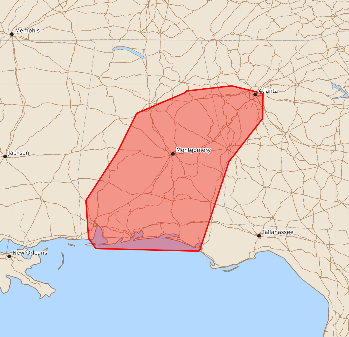
Summary
Isolated strong severe storms capable of producing wind gusts up to 60 mph are possible this afternoon and evening across the Florida Panhandle, southern and eastern Alabama, and far western Georgia.
Product Text
000 ACUS11 KWNS 301848 SWOMCD SPC MCD 301847 GAZ000-FLZ000-ALZ000-302015- Mesoscale Discussion 1397 NWS Storm Prediction Center Norman OK 0147 PM CDT Tue Jun 30 2026 Areas affected...the Florida Panhandle...southern/eastern Alabama...and far western Georgia. Concerning...Severe potential...Watch unlikely Valid 301847Z - 302015Z Probability of Watch Issuance...5 percent SUMMARY...A few strong to isolated severe storms are possible this afternoon and evening. DISCUSSION...Very strong instability (3000-3500 J/kg MLCAPE per SPC mesoanalysis) has developed across Alabama and Georgia where dewpoints are in the mid 70s with temperatures in the low to mid 90s. Lapse rates are quite weak, but with minimal inhibition and very strong instability, robust updrafts are anticipated. Deep-layer shear is quite weak which will limit storm organization somewhat. However, there is a stronger belt of flow (25-30 knots) sampled by the MXX VWP between 4 and 6 km. This may assist in some storm organization in an otherwise unfavorable deep-layer shear environment. This combination of instability and some mid-level flow may result in a few multicell storms capable of damaging wind gusts. However, a more organized severe weather threat is not anticipated and therefore, no watch is expected. ..Bentley/Guyer.. 06/30/2026 ...Please see www.spc.noaa.gov for graphic product... ATTN...WFO...FFC...TAE...BMX...MOB... LAT...LON 30098566 32188497 33188419 33768418 33948491 33828596 33778602 33308712 32418756 31278830 30398824 30158807 30098566 MOST PROBABLE PEAK WIND GUST...UP TO 60 MPH