Mesoscale Discussion 1608
Issued: · Valid: –
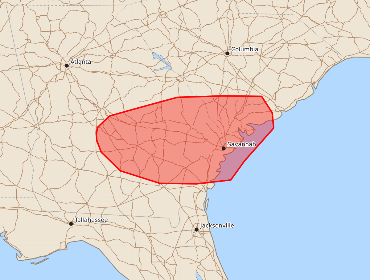
Summary
Severe thunderstorms capable of producing wind gusts between 55 and 70 mph are expected across southeastern Georgia and portions of North Carolina through early evening.
Product Text
000 ACUS11 KWNS 122230 SWOMCD SPC MCD 122229 SCZ000-GAZ000-122330- Mesoscale Discussion 1608 NWS Storm Prediction Center Norman OK 0529 PM CDT Sun Jul 12 2026 Areas affected...Southeastern Georgia into portions of North Carolina Concerning...Severe Thunderstorm Watch 486... Valid 122229Z - 122330Z The severe weather threat for Severe Thunderstorm Watch 486 continues. SUMMARY...The threat for WW 486 continues, with thunderstorms capable of damaging winds of 55-70 MPH. Additional thunderstorm development along merging outflows may need local watch extension. DISCUSSION...Additional thunderstorm development along merging outflows across portions of southern and eastern Georgia may become a short-term focus for thunderstorm development and damaging wind gusts. The additional convergence/ascent amidst modest buoyancy and high PWATs should produce additional thunderstorms with strong, wet downdrafts capable of 55-70 MPH winds. Local watch extension of WW 486 southward may be needed to account for this additional development. ..Halbert.. 07/12/2026 ...Please see www.spc.noaa.gov for graphic product... ATTN...WFO...CHS...CAE...JAX...FFC...TAE... LAT...LON 32448007 31758068 31368096 31288167 31298243 31558325 31948365 32188374 32308375 32458373 32698348 32848295 33088207 33118112 33108032 32768010 32448007 MOST PROBABLE PEAK WIND GUST...55-70 MPH