Mesoscale Discussion 1414
Issued: · Valid: –
Summary
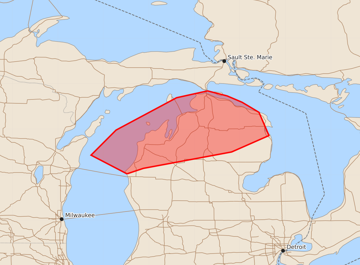
Severe thunderstorms capable of producing damaging winds and hail may impact northern Lower Michigan during the morning of July 1, 2026. These storms could bring wind gusts between 65 and 80 mph and hail up to 1.25 inches.
Product Text
000 ACUS11 KWNS 011328 SWOMCD SPC MCD 011328 MIZ000-011500- Mesoscale Discussion 1414 NWS Storm Prediction Center Norman OK 0828 AM CDT Wed Jul 01 2026 Areas affected...northern Lower Michigan Concerning...Severe potential...Watch possible Valid 011328Z - 011500Z Probability of Watch Issuance...60 percent SUMMARY...A severe thunderstorm watch may be needed across northern Michigan. DISCUSSION...A small but organized bowing segment has developed across central Wisconsin with a measured 53 knot wind gust at KOSH and several reports of wind damage across the area. This storm will likely undergo some weakening as it crosses the relatively cooler waters over Lake Michigan. However, an unstable and uncapped airmass is already present across northern Michigan with 2500+ J/kg MLCAPE and dewpoints in the mid to upper 70s per APX 12Z RAOB. In addition, 41 knots of effective shear will continue to support storm organization. Therefore, even if the bow weakens somewhat over the lake, reintensification across northern Michigan seems possible, especially given broken skies and additional surface heating this morning. Given the warm, moist airmass, severe/damaging winds would be the primary hazard. Trends will be monitored as this cluster crosses Lake Michigan and if it maintains strength or signs of imminent re-intensification across northern Michigan appear likely, a watch may be needed. ..Bentley/Guyer.. 07/01/2026 ...Please see www.spc.noaa.gov for graphic product... ATTN...WFO...APX...GRR... LAT...LON 44028648 44438727 44988672 45698539 45848471 45738428 45598395 45378358 44868336 44508418 44148612 44028648 MOST PROBABLE PEAK TORNADO INTENSITY...UP TO 90 MPH MOST PROBABLE PEAK WIND GUST...65-80 MPH MOST PROBABLE PEAK HAIL SIZE...UP TO 1.25 IN