Mesoscale Discussion 1172
Issued: · Valid: –
Summary
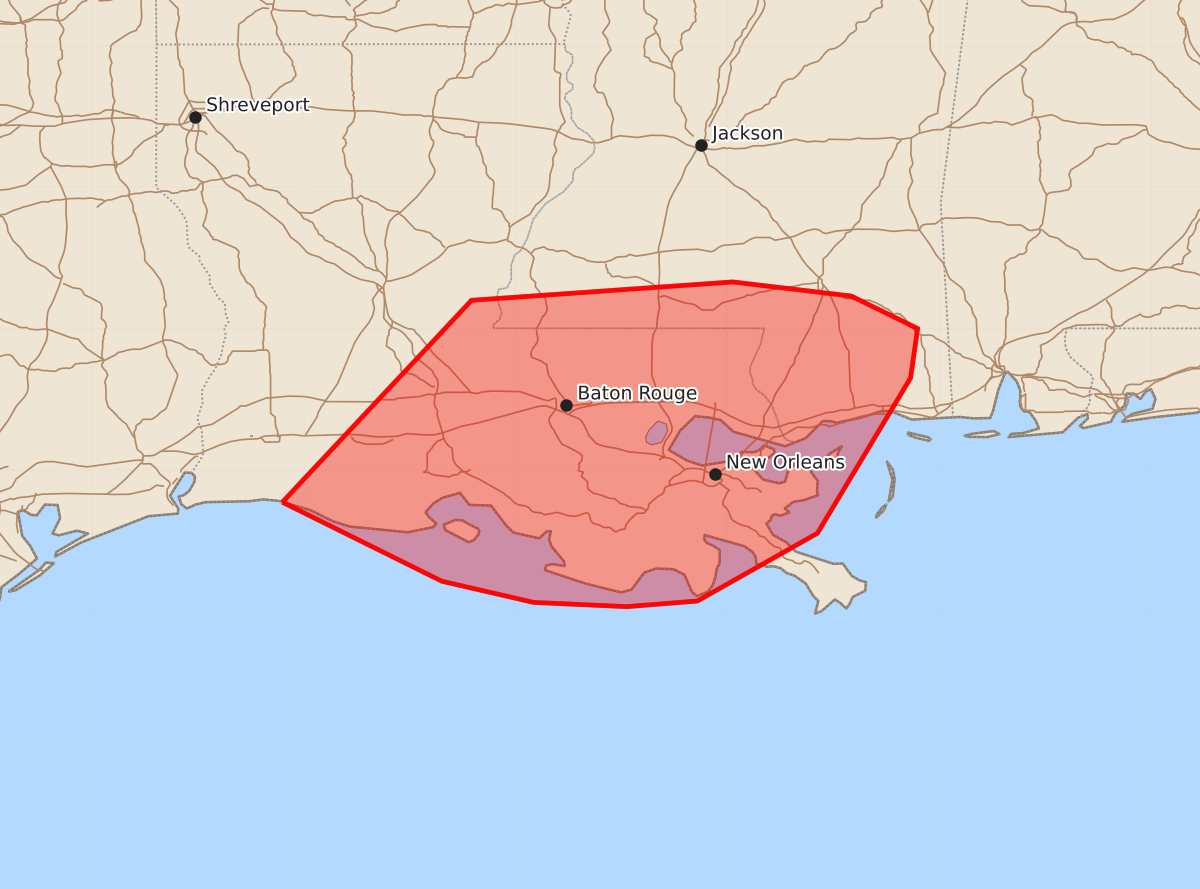
A threat of brief tornadoes is expected to increase across parts of southern Louisiana and southern Mississippi late this evening into the overnight hours.
Product Text
000 ACUS11 KWNS 180043 SWOMCD SPC MCD 180043 MSZ000-LAZ000-180315- Mesoscale Discussion 1172 NWS Storm Prediction Center Norman OK 0743 PM CDT Wed Jun 17 2026 Areas affected...Parts of southern LA/MS Concerning...Severe potential...Watch possible Valid 180043Z - 180315Z Probability of Watch Issuance...40 percent SUMMARY...A gradual increase in the tornado threat is expected into late evening. Watch issuance is possible. DISCUSSION...To the east of strongly sheared Tropical Storm Arthur, low-level flow is gradually increasing across parts of southeast LA and southern MS (as depicted in regional VWPs), and will continue to increase into late evening. Some backing of low-level flow is also expected as Arthur approaches the region, resulting in some enlargement of low-level hodographs. Given the presence of rich tropical moisture (with mid/upper 70s F dewpoints), this increase in low-level shear/SRH could aid in the development of transient, small supercells later this evening into the overnight, resulting in a threat for brief tornadoes. Tornado Watch issuance is increasingly possible later this evening in order to address this threat. ..Dean/Smith.. 06/18/2026 ...Please see www.spc.noaa.gov for graphic product... ATTN...WFO...MOB...JAN...LIX...LCH... LAT...LON 29779315 31209181 31338996 31238912 31008865 30658870 29558936 29079021 29039071 29069137 29219202 29779315 MOST PROBABLE PEAK TORNADO INTENSITY...85-110 MPH MOST PROBABLE PEAK WIND GUST...UP TO 60 MPH