Mesoscale Discussion 1271
Issued: · Valid: –
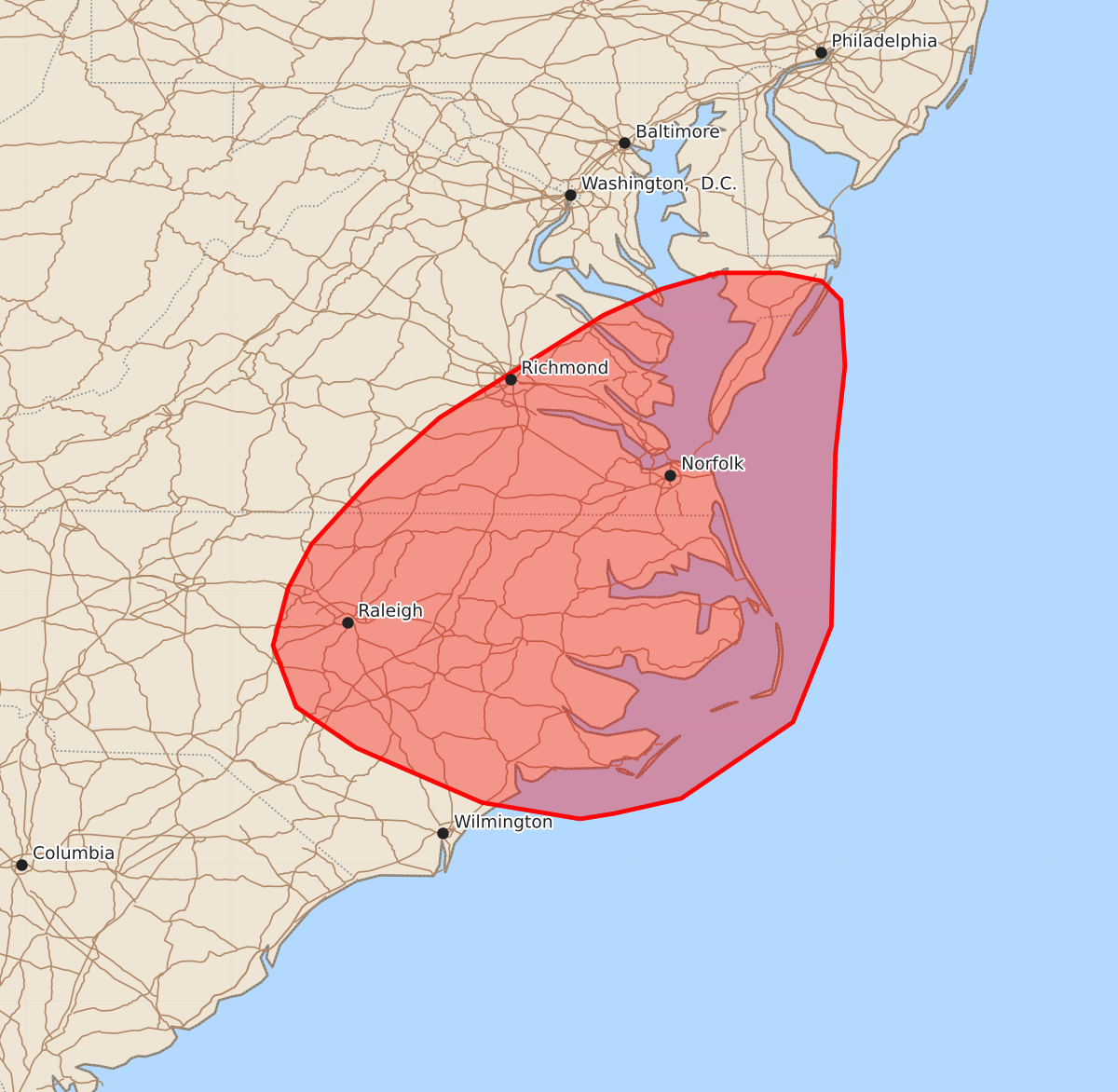
Summary
Severe thunderstorm potential will increase through this afternoon across portions of eastern North Carolina, southeastern Virginia, and southern Maryland, with damaging wind gusts and a slight risk of tornadoes expected.
Product Text
000 ACUS11 KWNS 231511 SWOMCD SPC MCD 231510 MDZ000-VAZ000-NCZ000-231645- Mesoscale Discussion 1271 NWS Storm Prediction Center Norman OK 1010 AM CDT Tue Jun 23 2026 Areas affected...portions of eastern North Carolina/Virginia into southern Maryland Concerning...Severe potential...Watch likely Valid 231510Z - 231645Z Probability of Watch Issuance...80 percent SUMMARY...Severe potential will increase through midday. Thunderstorm clusters will mainly pose a risk for damaging wind gusts through the afternoon. A severe thunderstorm watch will likely be needed in the next 1-2 hours. DISCUSSION...Clear skies and strong heating across eastern NC into southeast VA has allowed temperatures to rapidly rise into the 80s to near 90 F across the region late this morning. A very moist airmass with mid 70s dewpoints in in place, resulting in modest destabilization ahead of a surface cold front, and a growing cumulus field is already evident. Regional VWP data from RAX and LWX indicate around 30-40 kt southwesterly mid/upper flow spreading east across the area in tandem with a shortwave impulse. This is resulting in 25-35 kt effective shear magnitudes over the region (stronger with northward extent). Convection is already developing over the higher terrain of central NC/VA. The expectation is for this activity to gradually increase in intensity and organization as it spreads east into the Piedmont and coastal vicinity. Steep low-level lapse rates within the moist environment will support damaging gusts. There is also some indication of a remnant MCV from overnight convection moving across central NC. Given the very moist boundary layer and any enhancement to low-level shear this feature may pose, a tornado or two also could occur, though confidence in this scenario is low. Northward extent of greater severe risk is a bit uncertain. Cloudiness persists across MD/DE/southern NJ, and low-level flow is already veered. A strong storm or two could occur in these areas, especially given stronger flow, but storms may develop very near the coast in these areas and quickly move offshore. ..Leitman/Guyer.. 06/23/2026 ...Please see www.spc.noaa.gov for graphic product... ATTN...WFO...AKQ...MHX...LWX...RAH...ILM...RNK... LAT...LON 34337694 34457766 34857858 35157902 35607919 36027908 36347891 36827847 37277797 38027677 38217635 38337593 38337547 38277517 38137503 37657500 37017507 35747510 35047538 34487620 34377669 34337694 MOST PROBABLE PEAK TORNADO INTENSITY...UP TO 90 MPH MOST PROBABLE PEAK WIND GUST...55-70 MPH