Mesoscale Discussion 1171
Issued: · Valid: –
Summary
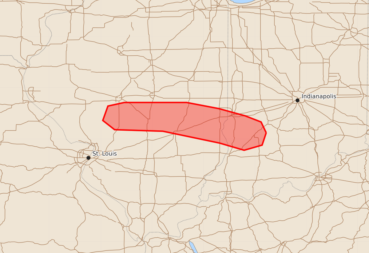
Large hail, damaging winds, and potential tornadoes will move through parts of south-central Illinois and southwest Indiana this evening. These storms may produce intense tornadoes, wind gusts exceeding 75 mph, and very large hail.
Product Text
000 ACUS11 KWNS 172351 SWOMCD SPC MCD 172350 INZ000-ILZ000-180145- Mesoscale Discussion 1171 NWS Storm Prediction Center Norman OK 0650 PM CDT Wed Jun 17 2026 Areas affected...Parts of south-central Illinois into southwest Indiana Concerning...Tornado Watch 342...344... Valid 172350Z - 180145Z The severe weather threat for Tornado Watch 342, 344 continues. SUMMARY...Large hail, damaging winds, and the potential for a few tornadoes will continue spreading east-southeastward this evening -- within Tornado Watches 342/344. DISCUSSION...A couple supercells are tracking east-southeastward along the southern flank of a larger convective cluster in east-central/southeast IL -- with additional development/intensification farther west in south-central IL. Despite the presence of very strong low/deep-layer flow/shear sampled by the IND VWP (60 kt low-level jet and 650-700 m2/s2 0-1 km SRH), these storms are tracking through a corridor of convectively processed air from earlier storms. However, the strong low-level mass response accompanying an approaching midlevel wave may support additional boundary-layer recovery toward the inflow of these storms during the next few hours. If this can occur, the robust low-level shear/streamwise vorticity will support a few tornadoes (some of which could be strong-intense) with any longer-lived supercells. Very large hail and severe wind gusts (75+ mph) will also be possible with these storms as they continue east-southeastward. ..Weinman.. 06/17/2026 ...Please see www.spc.noaa.gov for graphic product... ATTN...WFO...IND...ILX...LSX... LAT...LON 39128678 38888686 38788721 38928769 39158879 39188973 39368996 39648986 39718954 39718833 39598770 39458719 39338688 39128678 MOST PROBABLE PEAK TORNADO INTENSITY...120-145 MPH MOST PROBABLE PEAK WIND GUST...65-80 MPH MOST PROBABLE PEAK HAIL SIZE...2.00-3.50 IN