Mesoscale Discussion 1116
Issued: · Valid: –
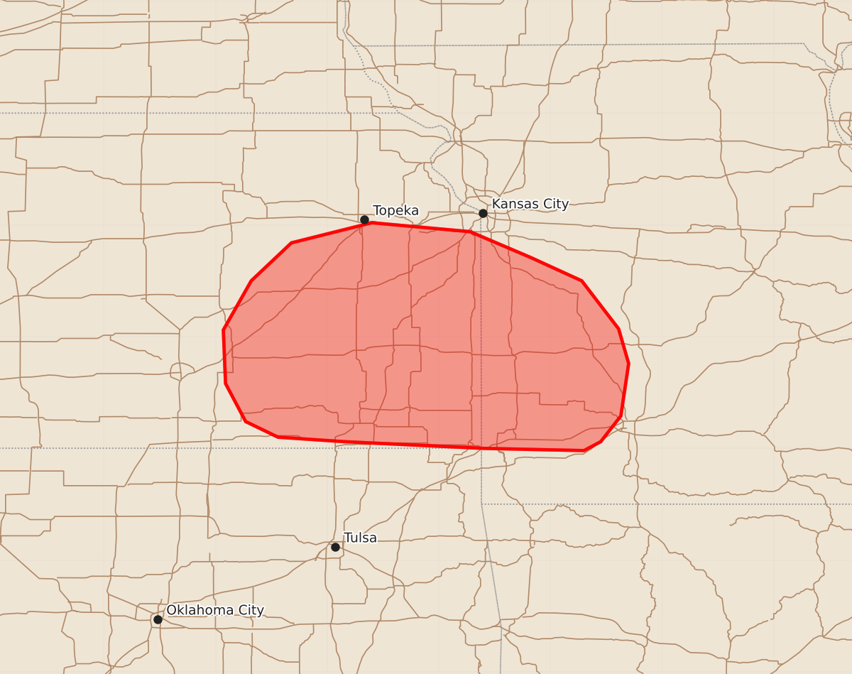
Summary
Isolated thunderstorms capable of producing large hail are expected to develop across southeast Kansas and spread into southwest Missouri during the early morning hours. The hail could reach sizes between 1.00 and 1.75 inches in diameter.
Product Text
000 ACUS11 KWNS 130443 SWOMCD SPC MCD 130442 MOZ000-KSZ000-130645- Mesoscale Discussion 1116 NWS Storm Prediction Center Norman OK 1142 PM CDT Fri Jun 12 2026 Areas affected...Southeast Kansas into southwest Missouri Concerning...Severe potential...Watch unlikely Valid 130442Z - 130645Z Probability of Watch Issuance...20 percent SUMMARY...Thunderstorm development appears likely in the coming hours across east/southeast Kansas, eventually spreading into southwest Missouri through the early morning. Large hail will be the primary hazard, but this threat should remain sufficiently isolated and transient to preclude watch issuance. DISCUSSION...Over the past 20-40 minutes, a pair of incipient thunderstorms have emerged within a deepening cumulus field from near Emporia, KS southward to the OK/KS border. This is likely due to the recent uptick in the nocturnal jet and isentropic ascent evident in the KVNX and KICT VWPs, which both show a gradual uptick in low-level winds and ground-relative SRH over the past couple of hours. This shallow convection may also be influenced by a subtle, but discernible, mid-level wave migrating southeast out of eastern NE/IA towards KS/MO. Recent RAP analyses and forecast soundings depict nearly uncapped most-unstable parcels between 850-800 mb, which aligns with the layer of increasing isentropic ascent noted in VWP observations. Consequently, it appears that additional thunderstorm development is likely over the next 1-3 hours across eastern KS. Modest mid-level lapse rates and somewhat weak forcing for ascent will likely yield gradually intensifying storms, but effective shear on the order of 30-40 knots should promote a few stronger, more organized cells capable of producing large hail (possibly as high as 1.25 to 1.75 inches in diameter). This activity is forecast to spread east into southwest MO with time, though continued storm development and eventual clustering may further modulate the coverage and intensity of the severe threat. Given these limitations, watch issuance is unlikely at this time. ..Moore/Gleason.. 06/13/2026 ...Please see www.spc.noaa.gov for graphic product... ATTN...WFO...SGF...EAX...TOP...ICT... LAT...LON 37009460 37069585 37109644 37249673 37589691 38069693 38509668 38849632 39029560 38949472 38719418 38509372 38079339 37769330 37299337 37069355 36989370 37009460 MOST PROBABLE PEAK WIND GUST...UP TO 60 MPH MOST PROBABLE PEAK HAIL SIZE...1.00-1.75 IN