Mesoscale Discussion 1141
Issued: · Valid: –
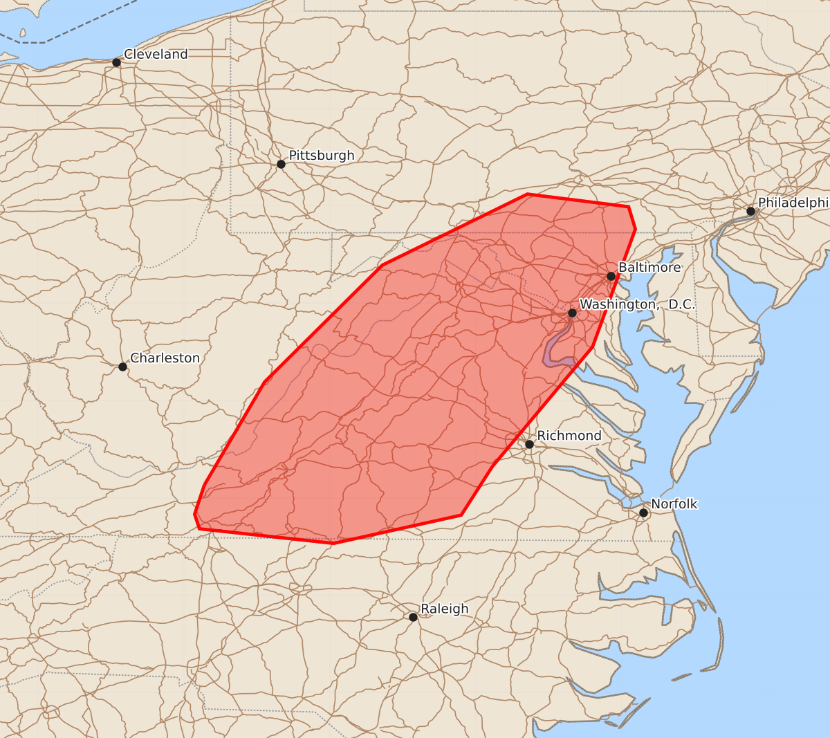
Summary
Severe thunderstorms capable of producing damaging winds are expected to move through portions of Virginia, southern Pennsylvania, and eastern Maryland this afternoon and evening. These storms may bring wind gusts between 55 and 70 mph and hail up to 1.25 inches.
Product Text
000 ACUS11 KWNS 141918 SWOMCD SPC MCD 141917 PAZ000-MDZ000-DCZ000-VAZ000-WVZ000-NCZ000-142115- Mesoscale Discussion 1141 NWS Storm Prediction Center Norman OK 0217 PM CDT Sun Jun 14 2026 Areas affected...portions of Virginia...far southern Pennsylvania...eastern Maryland Concerning...Severe potential...Severe Thunderstorm Watch likely Valid 141917Z - 142115Z Probability of Watch Issuance...80 percent SUMMARY...Thunderstorm clusters will move eastward with damaging wind potential into the afternoon/evening. DISCUSSION...Thunderstorm activity across the Shenandoah Valley and Blue Ridge Mountains will increase in coverage and intensity as they shift eastward into the more favorable air mass across central/eastern Virginia this afternoon. Additional thunderstorm development is likely downstream of the ongoing activity, with several areas of deepening cumulus noted in visible satellite. Mostly sunny skies through the morning has allowed for strong daytime heating and warming, with temperatures warming into the mid 90s. Higher theta-e air is advecting northward, with around 1000-2000 J/kg across southern Virginia. Steep low-level lapse rates are noted in SPC Mesoanalysis (7-8 C/km) and in the 18z RAOB from IAD. Though deep layer shear is marginal (around 20-30 kts), very warm and unstable conditions amid steep low to mid level lapse rates will support potential for water laden downdrafts and severe winds. A watch will likely be needed to cover this potential this afternoon. ..Thornton/Mosier.. 06/14/2026 ...Please see www.spc.noaa.gov for graphic product... ATTN...WFO...AKQ...CTP...LWX...RNK...PBZ...RLX... LAT...LON 37138079 38198017 39397896 40127747 39997643 39767636 38557680 37327783 36827815 36537946 36688084 36838089 37138079 MOST PROBABLE PEAK TORNADO INTENSITY...UP TO 90 MPH MOST PROBABLE PEAK WIND GUST...55-70 MPH MOST PROBABLE PEAK HAIL SIZE...UP TO 1.25 IN