Day 1 Convective Outlook
Issued: · Valid: –
Summary
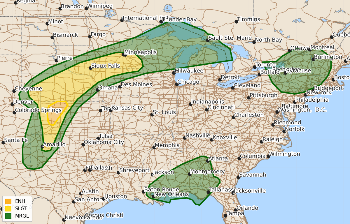
Severe thunderstorms capable of producing damaging wind gusts and large hail are expected across parts of western Kansas and the central High Plains overnight. Additional severe thunderstorms are possible across the Great Lakes, Northeast, and portions of the central Plains and middle Missouri Valley.
Product Text
000 ACUS01 KWNS 010107 SWODY1 SPC AC 010106 Day 1 Convective Outlook NWS Storm Prediction Center Norman OK 0806 PM CDT Tue Jun 30 2026 Valid 010100Z - 011200Z ...THERE IS AN ENHANCED RISK OF SEVERE THUNDERSTORMS ACROSS PARTS OF WESTERN KANSAS... ...SUMMARY... Scattered severe thunderstorms will continue across parts of the central High Plains, with severe wind gusts being the primary hazard. Other severe thunderstorms are still possible across the Great Lakes and Northeast, as well as broader parts of the central Plains to middle Missouri Valley. ...Central Plains into the Upper MS Valley... Between a broad large-scale trough over the West and an expansive upper ridge over the eastern half of the CONUS, a belt of enhanced midlevel southwesterly flow is yielding around 40-50 kt of effective shear from the central Plains into the upper MS Valley. Here, middle/upper 60s to lower 70s dewpoints beneath steep midlevel lapse rates (sampled by 00Z observed soundings) are contributing to moderate-strong surface-based buoyancy. Despite gradual nocturnal boundary-layer cooling, this buoyancy and deep-layer shear will continue to promote the development of loosely organized convective clusters and supercell structures spreading northeastward overnight. The primary concern with this activity will be damaging/severe wind gusts (some upwards of 75 mph) and large hail. ...Northeast... A band of thunderstorms tracking southeastward across southern Ontario could spread into parts of NY tonight, and given an established cold pool, damaging winds will be possible. However, surface observations and the 00Z ALB sounding suggest lingering low-level static stability in the wake of earlier convection may limit the overall severe risk. ..Weinman.. 07/01/2026 $$