Mesoscale Discussion 1972
Issued: · Valid: –
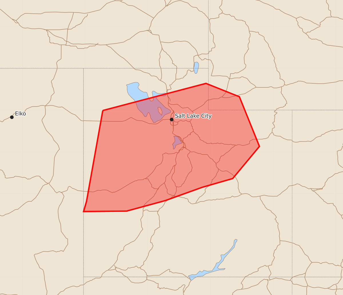
Summary
Scattered to numerous thunderstorms across northern and central Utah into far southwest Wyoming may bring isolated severe wind gusts and hail this evening.
Product Text
000 ACUS11 KWNS 132317 SWOMCD SPC MCD 132316 UTZ000-WYZ000-140115- Mesoscale Discussion 1972 NWS Storm Prediction Center Norman OK 0616 PM CDT Thu Aug 13 2026 Areas affected...Portions of northern and central Utah into far southwest Wyoming Concerning...Severe potential...Watch unlikely Valid 132316Z - 140115Z Probability of Watch Issuance...20 percent SUMMARY...Scattered to numerous thunderstorms ongoing over parts of the eastern Great Basin and Intermountain West may pose a risk for isolated strong/severe gusts this evening. Storm organization will be limited and a watch is unlikely. DISCUSSION...As of 2310 UTC, regional radar and visible imagery showed numerous thunderstorms ongoing within a plume of monsoon moisture over the eastern Great Basin. Over the last hour, a more robust cluster of storms has emerged across parts of northwestern UT. The environment downstream remains warm and quite moist, with dewpoints in the low 50s F. This is supporting around 1000 J/kg of MLCAPE across northern and central UT, which will be sufficient for strong updrafts. While the air mass is more moist than typical with PWATS near or exceeding 1 inch, area RAP soundings show steep lapse rates in the lowest 1-2 km with T/TD spread around 30 degrees F. This is more than sufficient to support stronger downdrafts and strong/severe gusts within the ongoing convection, especially with the more clustered storms. Some hail will also be possible with the stronger intermittent cores. Several mesonet sites have already reported gusts in the 45-50 kt range. This looks likely to continue as convective coverage slowly increases. While strong/severe gusts will be possible into this evening, little in the way of storm organization is expected owing modest deep-layer shear around 20 kt. This suggest the strongest storms are likely to be transient. Additionally, convection will gradually move eastward into a cooler air mass with weaker lapse rates and buoyancy across northern UT and far southwest WY this evening. This suggests the overall risk for severe gusts and hail should be isolated and a Watch is unlikely. ..Lyons/Hart.. 08/13/2026 ...Please see www.spc.noaa.gov for graphic product... ATTN...WFO...RIW...GJT...SLC... LAT...LON 40991358 41641111 41321031 40130983 39361047 39151120 38831209 38581301 38571404 38811397 40991358 MOST PROBABLE PEAK WIND GUST...55-70 MPH MOST PROBABLE PEAK HAIL SIZE...UP TO 1.25 IN