Mesoscale Discussion 1792
Issued: · Valid: –
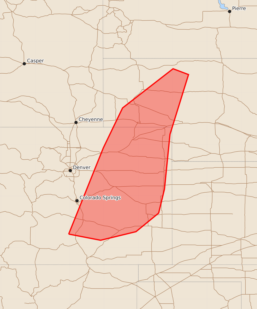
Summary
Severe thunderstorms capable of producing large hail and wind gusts up to 70 mph will affect eastern Colorado and the northeast Panhandle through the evening.
Product Text
000 ACUS11 KWNS 282303 SWOMCD SPC MCD 282302 NEZ000-COZ000-290030- Mesoscale Discussion 1792 NWS Storm Prediction Center Norman OK 0602 PM CDT Tue Jul 28 2026 Areas affected...Eastern CO into the NE Panhandle Concerning...Severe Thunderstorm Watch 528... Valid 282302Z - 290030Z The severe weather threat for Severe Thunderstorm Watch 528 continues. SUMMARY...A threat for hail and localized severe gusts will continue into the evening. DISCUSSION...Scattered strong to severe storms are ongoing at 23 UTC from eastern CO into the NE Panhandle. MLCAPE of 1500-2500 J/kg and effective shear of 30-40 kt (greater with northward extent) will continue to support organized storm structures into this evening, with a continued threat for isolated hail and severe gusts. Potential for organized upscale growth may tend to be limited by generally weak large-scale ascent and the expected lack of nocturnal low-level jet development. However, moist low-level easterly flow may allow for some clustering along expanding outflows, supporting a continued localized severe-wind risk as convection spreads eastward with time. ..Dean.. 07/28/2026 ...Please see www.spc.noaa.gov for graphic product... ATTN...WFO...LBF...GLD...PUB...BOU...CYS... LAT...LON 37890503 40400402 41560346 42700199 42530154 40790208 39200224 38500241 37960307 37710410 37890503 MOST PROBABLE PEAK WIND GUST...55-70 MPH MOST PROBABLE PEAK HAIL SIZE...1.00-1.75 IN