Mesoscale Discussion 1388
Issued: · Valid: –
Summary
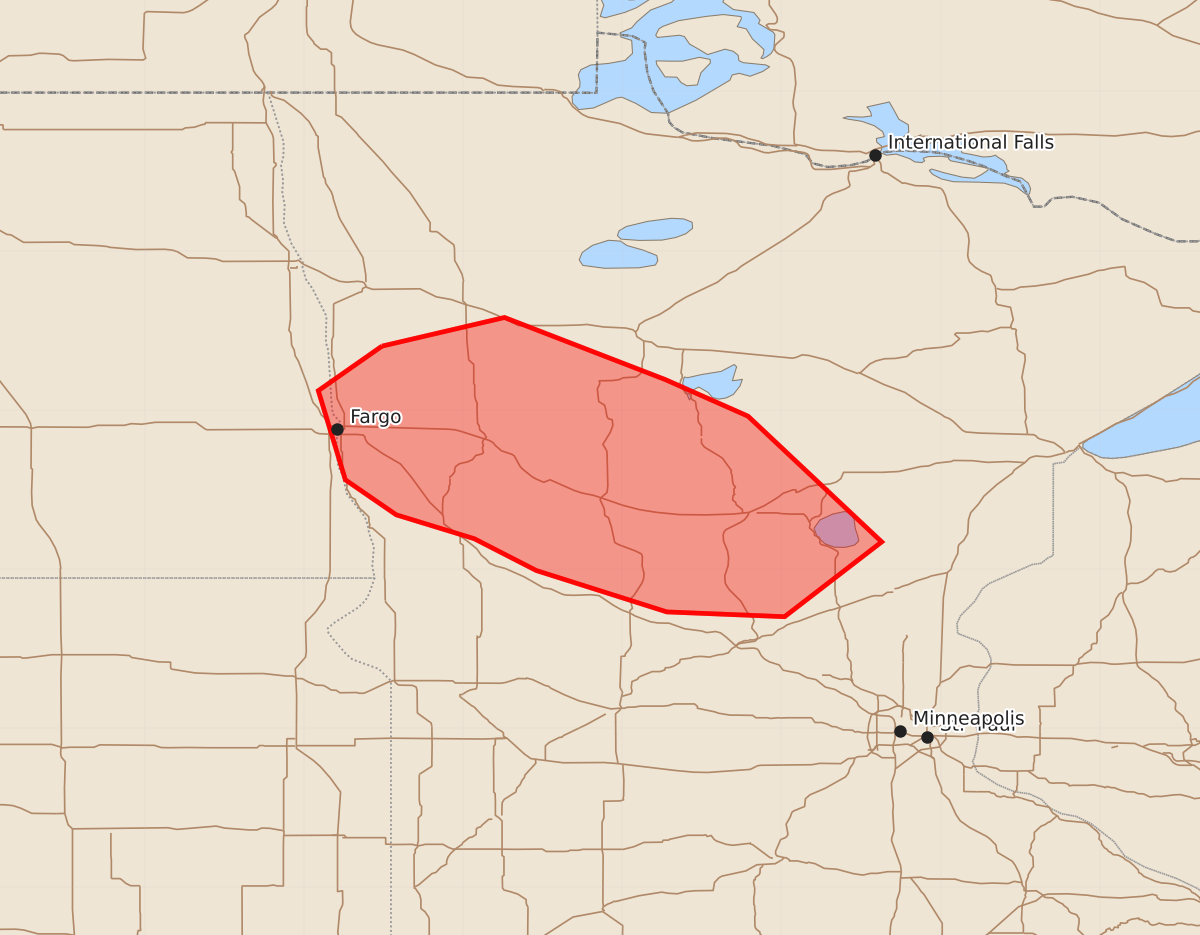
Developing supercells capable of producing large hail and strong tornadoes may affect parts of east central North Dakota and northwest through central Minnesota between 4:00 PM and 6:00 PM CDT. The severity of these storms is expected to increase during this period.
Product Text
000 ACUS11 KWNS 300025 SWOMCD SPC MCD 300025 MNZ000-NDZ000-300230- Mesoscale Discussion 1388 NWS Storm Prediction Center Norman OK 0725 PM CDT Mon Jun 29 2026 Areas affected...parts of east central North Dakota...northwest through central Minnesota Concerning...Severe potential...Watch likely Valid 300025Z - 300230Z Probability of Watch Issuance...80 percent SUMMARY...Developing supercells posing a risk for large hail and a couple strong tornadoes may increase through 9-11 PM CDT. DISCUSSION...Very moist boundary-layer air (including mid 70s F surface dew points) advecting into the vicinity of a deep surface low centered northeast of Bismarck is contributing to extreme potential instability beneath steep-lapse rates associated with a plume of very warm elevated mixed layer air. However, a combination of subsidence aloft and inhibition associated with the elevated mixed-layer has slowed convective development to this point. A recent increase in deepening convective development is finally underway near the leading edge of gradual weak cooling from the west in the 700-500 mb layer, as well as along a retreating downstream remnant outflow boundary/developing warm front, roughly centered northeast of Alexandria MN. Particularly along the warm front, where a 40+ kt southerly 850 mb jet is contributing to sizable clockwise-curved low-level hodographs, the environment may become increasingly conducive to supercells posing a risk for tornadoes. The southern fringe of modest mid-level height falls, associated with a northeastward pivoting upstream short wave trough, may not begin impacting the area until 02-04Z, but it appears this threat could commence a bit earlier. ..Kerr/Thompson.. 06/30/2026 ...Please see www.spc.noaa.gov for graphic product... ATTN...WFO...DLH...MPX...FGF... LAT...LON 47409651 47589574 47199473 46969421 46179337 45709398 45739472 45999554 46199593 46349642 46569674 47129691 47409651 MOST PROBABLE PEAK TORNADO INTENSITY...120-145 MPH MOST PROBABLE PEAK WIND GUST...55-70 MPH MOST PROBABLE PEAK HAIL SIZE...2.00-3.50 IN