Mesoscale Discussion 1604
Issued: · Valid: –
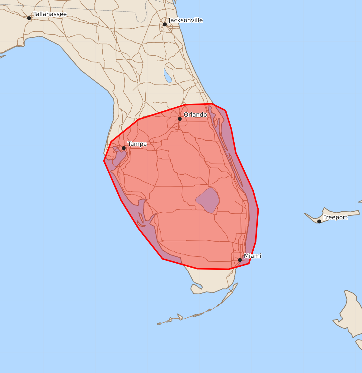
Summary
Isolated damaging wind gusts are spreading through Central Florida this afternoon, with a potential for similar wind gusts and large hail across South Florida later today. These scattered severe weather threats are expected to remain isolated through the evening.
Product Text
000 ACUS11 KWNS 121914 SWOMCD SPC MCD 121914 FLZ000-122115- Mesoscale Discussion 1604 NWS Storm Prediction Center Norman OK 0214 PM CDT Sun Jul 12 2026 Areas affected...portions of Central and South Florida Concerning...Severe potential...Watch unlikely Valid 121914Z - 122115Z Probability of Watch Issuance...5 percent SUMMARY...Some risk for isolated damaging wind gusts is spreading southward into Central Florida. A conditional risk for isolated damaging wind gusts and large hail exists farther south across South Florida. DISCUSSION...An ongoing cluster of loosely organized thunderstorms has continued to spread southward across portions of Central Florida over the past 1-2 hours and has recently produced a measured 41 mph wind gust in the vicinity of Titusville along the Atlantic Coast. Despite weak deep-layer flow/shear, the environment south of this convection remains favorable for isolated damaging wind gusts, with steep low-level lapse rates, rich moisture, and moderate to strong instability in place. Farther south, a developing Cu field is noted across South Florida. Latest high-res guidance continues to suggest that an isolated storm or two may develop along the sea breeze over the next couple of hours. Locally greater moisture and buoyancy are noted across this area, with up to 3500 J/kg MLCAPE depicted by objective analysis. Coupled with cooler mid-level temperatures and steeper mid-level lapse rates (-9.5 C at 500 mb and 7-7.5 C/km, respectively, sampled by the 12z MFL observed sounding) compared to areas farther north, this would support a conditional threat for isolated damaging wind gusts and large hail (perhaps to half-dollar size) with any storm that does form in this environment. Given the isolated nature of these threats, watch issuance appears unlikely at this time. ..Chalmers/Smith.. 07/12/2026 ...Please see www.spc.noaa.gov for graphic product... ATTN...WFO...MFL...MLB...TBW... LAT...LON 25728005 25618044 25628104 25818171 26398217 26948251 27708284 28078270 28508217 28788128 28808076 28678050 28328039 27858030 27137997 26767987 26147992 25728005 MOST PROBABLE PEAK WIND GUST...UP TO 60 MPH MOST PROBABLE PEAK HAIL SIZE...UP TO 1.25 IN