Mesoscale Discussion 1763
Issued: · Valid: –
Summary
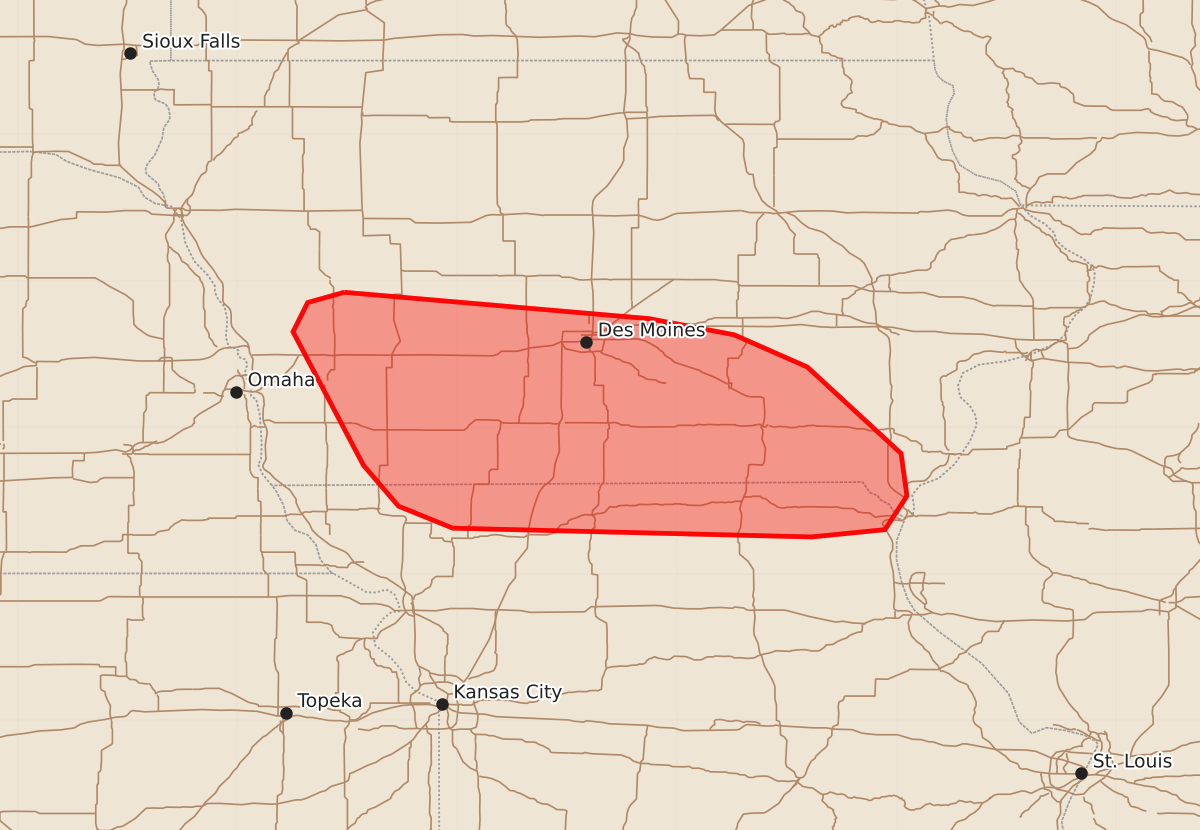
Isolated large hail may occur through mid-afternoon across southern Iowa and far northern Missouri. The expected severity is low, with hail sizes likely remaining at 1.25 inches or less.
Product Text
000 ACUS11 KWNS 271749 SWOMCD SPC MCD 271749 IAZ000-MOZ000-271945- Mesoscale Discussion 1763 NWS Storm Prediction Center Norman OK 1249 PM CDT Mon Jul 27 2026 Areas affected...Southern Iowa into far northern Missouri Concerning...Severe potential...Watch unlikely Valid 271749Z - 271945Z Probability of Watch Issuance...5 percent SUMMARY...An isolated hail threat may materialize through mid-afternoon across southern Iowa into far northern Missouri. In general, this activity is expected to remain sufficiently weak to negate the need for a watch. DISCUSSION...Convection has been gradually deepening per MRMS VIL and echo top imagery over the past hour across southwest to south-central IA. This activity appears to be largely driven by modest ascent along a weak frontal zone draped across the Plains, and is maturing within an environment featuring ample buoyancy (MUCAPE of around 3000 J/kg) and sufficient deep-layer wind shear for organized convection based on the KDMX VWP (which sampled a 0-6 km BWD of just under 25 knots). Given this environment, loosely organized convection appears possible and may pose a threat for sporadic large hail - most likely 1.25 inch or less. The primary modulating factor to overall storm longevity and intensity is increasing inhibition with southward extent and a lack of stronger synoptic forcing for ascent. Consequently, storms will most likely begin to weaken as they track south/southeast (this behavior has already been observed with a few leading cells) and will mainly pose an isolated/transient severe threat through the afternoon. ..Moore/Hart.. 07/27/2026 ...Please see www.spc.noaa.gov for graphic product... ATTN...WFO...LSX...DVN...DMX...EAX...OAX... LAT...LON 41929527 41749319 41639261 41419211 40829147 40539143 40309158 40259208 40319453 40469490 40749514 41659562 41859552 41929527 MOST PROBABLE PEAK WIND GUST...UP TO 60 MPH MOST PROBABLE PEAK HAIL SIZE...UP TO 1.25 IN