Mesoscale Discussion 1627
Issued: · Valid: –
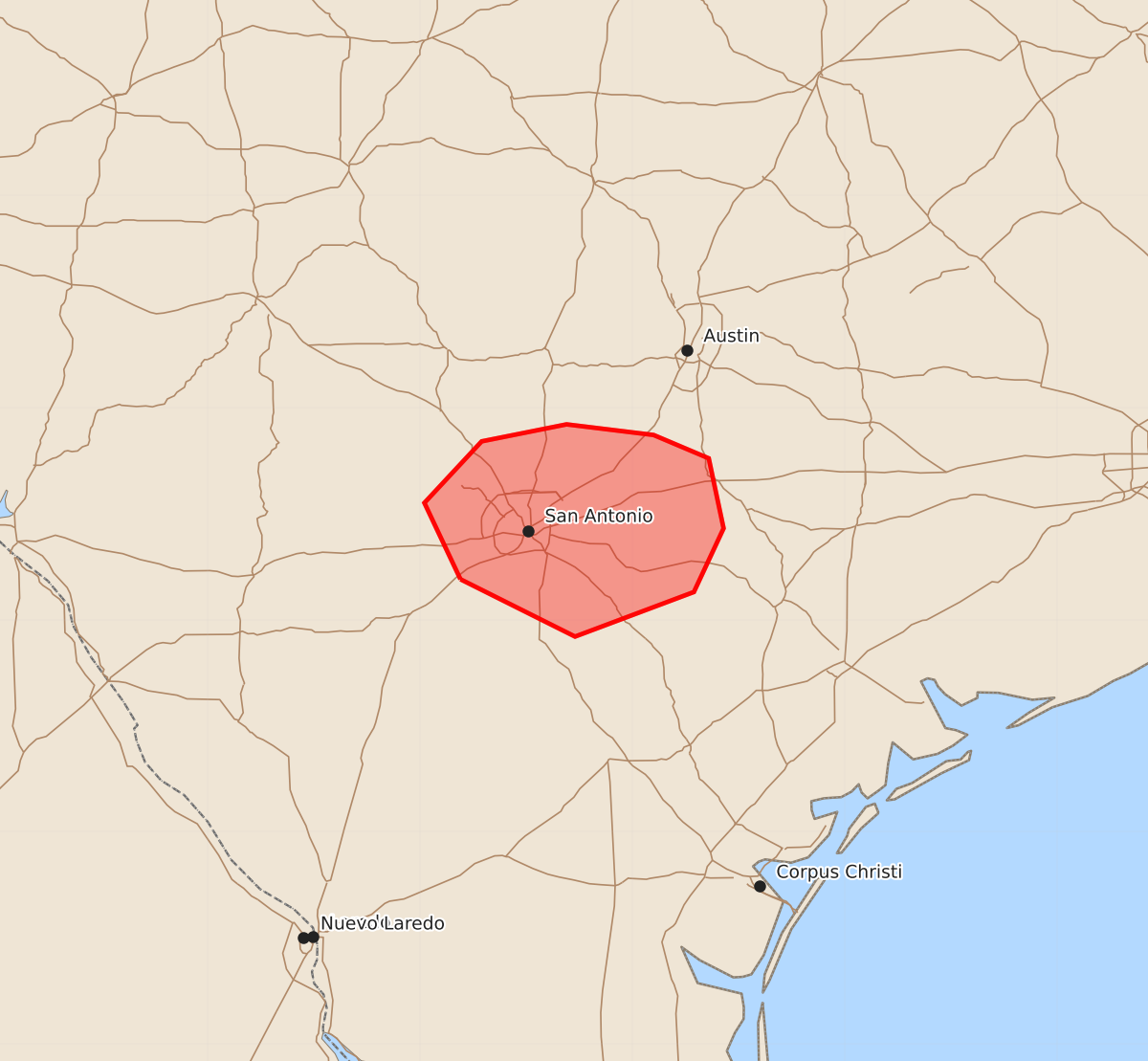
Summary
A brief and localized tornado threat may develop in the San Antonio metro area this evening.
Product Text
000 ACUS11 KWNS 152223 SWOMCD SPC MCD 152223 TXZ000-160030- Mesoscale Discussion 1627 NWS Storm Prediction Center Norman OK 0523 PM CDT Wed Jul 15 2026 Areas affected...south-central Texas...including the San Antonio metro area Concerning...Severe potential...Watch unlikely Valid 152223Z - 160030Z Probability of Watch Issuance...20 percent SUMMARY...A localized brief tornado threat may evolve this evening in the San Antonio metro area. A watch is not currently expected. DISCUSSION...Low-level warm advection/isentropic ascent to the north of an outflow boundary situated to the immediate south of the San Antonio metro area is fostering recurring shower and thunderstorm development with some weak rotation evident in radar data. The current KEWX VWP, located to the north of the boundary, exhibits pronounced veering of winds through the lowest 1 km AGL with estimated SRH of 150-200 m2/s2 through that layer. The air mass to the immediate north of the outflow boundary is quite moist with dewpoints in the lower 70s, which are largely contributing to MLCAPE of around 1000 J/kg. However, given the cooler boundary-layer temperatures, low-level lapse rates are relatively weak, which may limit parcel accelerations in the lower part of the storms. Nonetheless, the presence of modest low-level shear and a moist/low LCL environment indicates some potential for a brief tornado this evening. Given the localized and brief nature of the tornado threat, a watch is not currently expected. ..Mead/Guyer.. 07/15/2026 ...Please see www.spc.noaa.gov for graphic product... ATTN...WFO...EWX... LAT...LON 29199881 29559898 29849871 29929831 29879790 29769764 29439757 29139771 28929827 29199881 MOST PROBABLE PEAK TORNADO INTENSITY...UP TO 90 MPH