Mesoscale Discussion 1069
Issued: · Valid: –
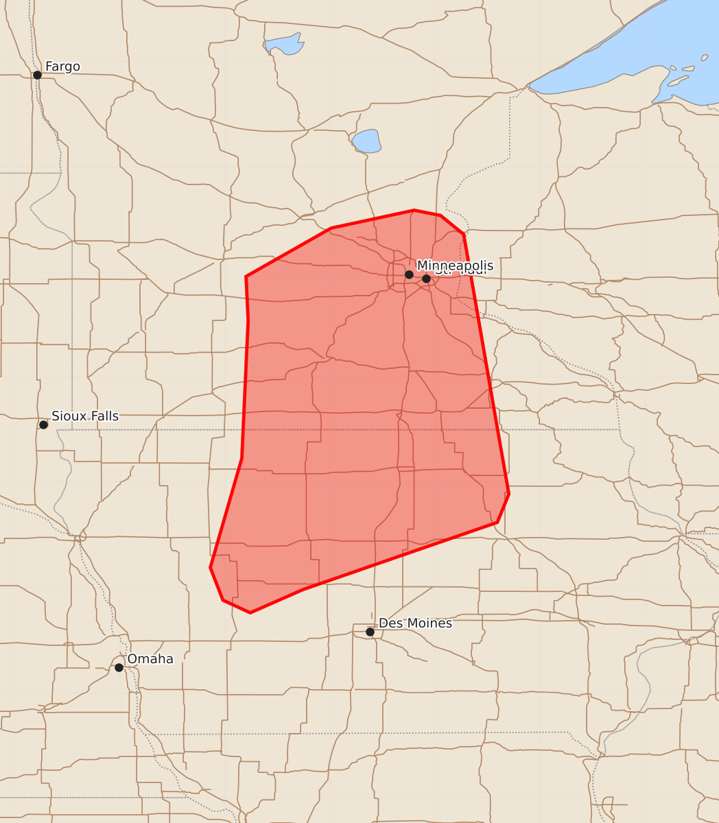
Summary
Isolated strong to severe storms capable of producing large hail and damaging wind gusts are possible across northern Iowa and southern Minnesota later this afternoon.
Product Text
000 ACUS11 KWNS 101940 SWOMCD SPC MCD 101939 MNZ000-IAZ000-WIZ000-102145- Mesoscale Discussion 1069 NWS Storm Prediction Center Norman OK 0239 PM CDT Wed Jun 10 2026 Areas affected...northern Iowa into southern Minnesota Concerning...Severe potential...Watch possible Valid 101939Z - 102145Z Probability of Watch Issuance...40 percent SUMMARY...Isolated strong to severe storms are possible later this afternoon from northern Iowa into southern Minnesota. Hail and locally damaging gusts appear most likely. DISCUSSION...A cold front continues to push east across western MN and IA, with rapidly veering surface winds and drying. Lapse rates remain steep due to cool temperatures aloft and daytime heating, with attempts at deeper convection noted across the warm sector. Eastern parts of MN and IA remain under the influence of outflow from earlier storm activity. However, at least surface air mass recovery will occur ahead of the cold front. Given this area is in between the shortwave trough to the north and the departing MCS over WI and IL, the degree of new storm coverage in this zone is uncertain. However, at least isolated storms appear likely later this afternoon, with locally severe hail or strong wind gusts. ..Jewell.. 06/10/2026 ...Please see www.spc.noaa.gov for graphic product... ATTN...WFO...ARX...MPX...DMX...FSD... LAT...LON 41989426 41769476 41889502 42199514 43239484 44119480 44549478 44969480 45429399 45599320 45549295 45369273 44739262 43469240 42899230 42629241 42249351 41989426 MOST PROBABLE PEAK TORNADO INTENSITY...UP TO 90 MPH MOST PROBABLE PEAK WIND GUST...55-70 MPH MOST PROBABLE PEAK HAIL SIZE...1.50-2.50 IN