Mesoscale Discussion 1527
Issued: · Valid: –
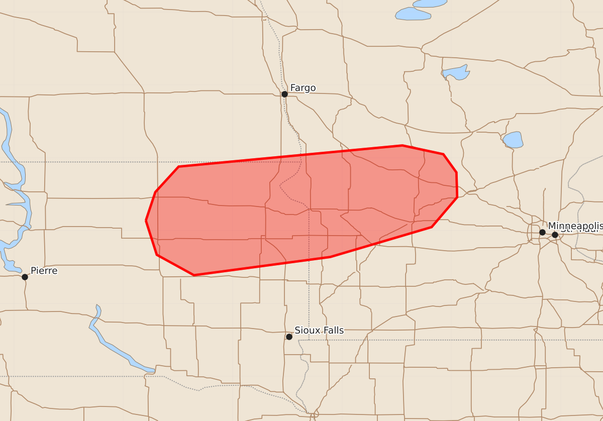
Summary
Strong to severe thunderstorms capable of producing large hail and damaging wind gusts are possible across northeast South Dakota and west-central to central Minnesota beginning this evening through late tonight. These storms may become increasingly widespread as the evening progresses.
Product Text
000 ACUS11 KWNS 062211 SWOMCD SPC MCD 062210 MNZ000-SDZ000-NDZ000-070045- Mesoscale Discussion 1527 NWS Storm Prediction Center Norman OK 0510 PM CDT Mon Jul 06 2026 Areas affected...northeast SD...west-central into central MN Concerning...Severe potential...Watch possible Valid 062210Z - 070045Z Probability of Watch Issuance...60 percent SUMMARY...Strong to severe thunderstorm development will become increasingly possible with time and perhaps this begins as early as 6pm-8pm CDT. Isolated to scattered large hail and severe gusts are possible with the stronger storms through late evening. DISCUSSION...Visible-satellite imagery shows partly cloudy skies with a thin cirrus shield located to the southeast of an approaching front that is currently analyzed over southeast ND. Surface observations over eastern SD and west-central MN show temperatures in the upper 80s with lower 70s deg F dewpoints. The 20z model run of the RAP seems adequately representative of the surface conditions and it shows 4000 J/kg MLCAPE with PW in excess of 1.8 inches. Fairly weak southerly low-level flow veers to westerly and 20-kt in the 500-300 mb layer and this is supporting around 25-kt effective shear. Short-term model guidance continues to suggest storms will eventually develop over the southern part of Severe Thunderstorm Watch #466 near the ND-SD-MN border region early this evening. Additional storms are possible over northeast SD into west-central MN this evening. Contingent on storm development occurring, it seems plausible at least an isolated to perhaps scattered severe-storm risk will develop beginning this evening. It remains unclear regarding storm evolution and the need for a severe thunderstorm watch due in part to storm coverage and propensity for severe hail/wind, but mesoscale conditions will continue to be monitored. ..Smith/Gleason.. 07/06/2026 ...Please see www.spc.noaa.gov for graphic product... ATTN...WFO...MPX...FGF...FSD...ABR... LAT...LON 45149869 45539856 45889824 46179517 46059461 45809443 45469442 45059477 44649616 44399803 44679854 45149869 MOST PROBABLE PEAK WIND GUST...65-80 MPH MOST PROBABLE PEAK HAIL SIZE...1.50-2.50 IN