Day 3 Convective Outlook
Issued: · Valid: –
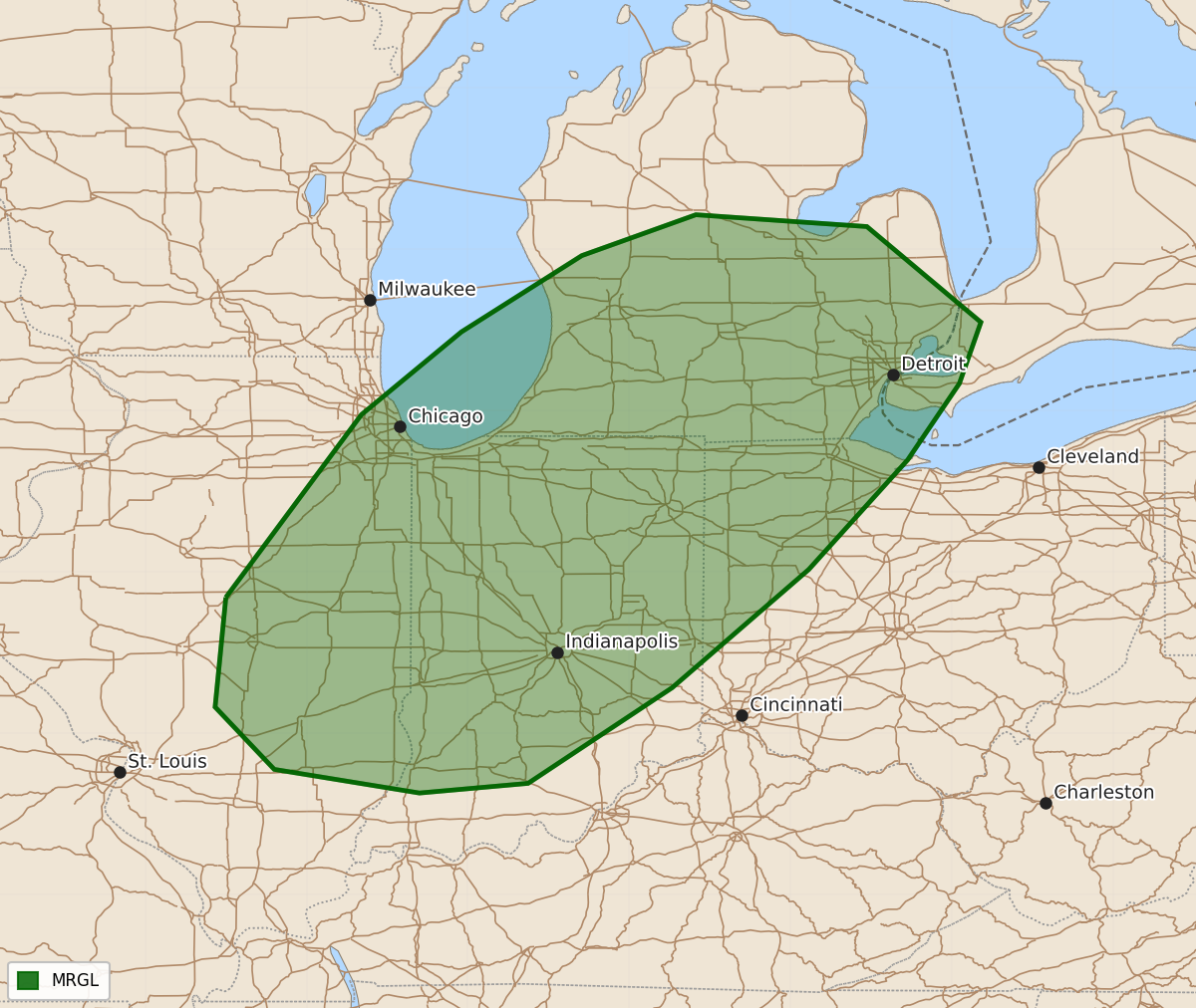
Summary
Isolated strong to severe thunderstorms are possible Tuesday afternoon and evening across parts of the Midwest into Lower Michigan. These storms may produce gusty winds and hail.
Product Text
000 ACUS03 KWNS 141928 SWODY3 SPC AC 141927 Day 3 Convective Outlook NWS Storm Prediction Center Norman OK 0227 PM CDT Sun Jun 14 2026 Valid 161200Z - 171200Z ...THERE IS A MARGINAL RISK OF SEVERE THUNDERSTORMS ACROSS PORTIONS OF THE MIDWEST INTO LOWER MICHIGAN... ...SUMMARY... Isolated strong to severe thunderstorms are possible Tuesday afternoon and evening across parts of the Midwest into Lower Michigan. ... Synopsis ... Broad mid-level troughing across the eastern US will persist on Tuesday. A short-wave trough will move across the Great Lakes as it moves through the basal region of the eastern US long-wave trough. Late in the forecast period, a second short-wave trough will dig southeast into the northern Plains. At the surface, one front will be draped across the northern Gulf Coast states, suppressing the richest boundary layer moisture to the south. A second front will quickly move from the Upper Midwest across the Ohio Valley into the Lower Great Lakes by Wednesday morning as a surface low slowly pivots across the Lake Superior. Overnight Tuesday, cyclogenesis will occur across the northern Plains in response to the approaching short-wave trough. A deepening surface low will induce more substantial northward moisture advection from the southern into central Plains. ... Midwest into Lower Michigan ... Low-level moisture return will be tempered on Tuesday, owing to the stalled front across the northern Gulf Coast states and only modest low-level mass response to the approaching mid-level short-wave trough. That said, modest southwesterly moisture advection ahead of the cold front should support a narrow corridor of surface dewpoints rising into the upper-50Fs to low-60Fs. At the same time, mid-level lapse rates should steepen with the approaching trough, resulting in MUCAPE between 500-1500 J/kg, conditioned on the quality of the moisture return. Storms, perhaps multiple rounds, should develop along or ahead of the advancing front. Gusty winds and hail should be the main hazards, with storms generally weakening with eastward extent due to the loss of diurnal heating and weaker moisture return. ..Marsh.. 06/14/2026 $$