Mesoscale Discussion 1221
Issued: · Valid: –
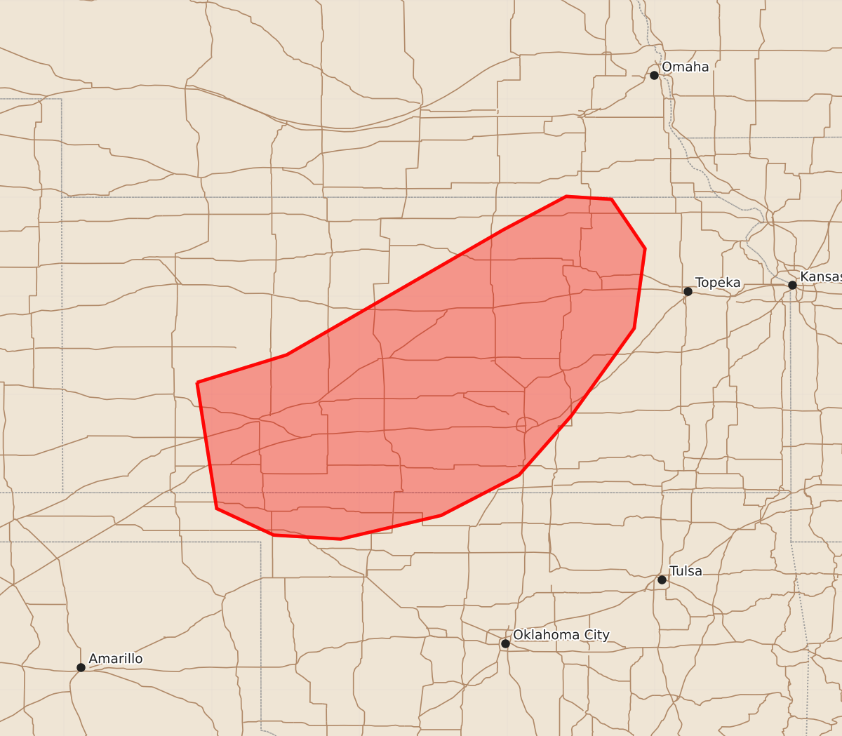
Summary
Severe thunderstorms capable of producing damaging wind gusts and hail will continue to move across western and central Kansas through early morning hours on June 21. The storm system is expected to maintain severe intensity for at least the next few hours.
Product Text
000 ACUS11 KWNS 210425 SWOMCD SPC MCD 210424 KSZ000-NEZ000-OKZ000-210600- Mesoscale Discussion 1221 NWS Storm Prediction Center Norman OK 1124 PM CDT Sat Jun 20 2026 Areas affected...portions of western into central Kansas Concerning...Severe Thunderstorm Watch 359...361... Valid 210424Z - 210600Z The severe weather threat for Severe Thunderstorm Watch 359, 361 continues. SUMMARY...Severe gusts will remain a concern with the ongoing MCS for at least the next few hours. DISCUSSION...A mature cold-pool-driven MCS continues to propagate southeastward across western into central KS, with several recent measured severe gusts noted. Recent KICT inbound velocity data shows that a pronounced rear-inflow jet persists with this MCS, as well as a book-end/line-end mesovortex on its northern flank. Furthermore, this MCS will continue to progress southeastward amid a highly sheared and buoyant airmass, characterized by 50 kts of effective bulk shear (oriented roughly normal to the MCS leading line) and 2000+ J/kg MLCAPE, driven by 8+ C/km mid-level lapse rates. Given the highly organized storm structure and favorable ambient supporting environment, severe gusts will likely continue with this MCS for at least a few more hours. ..Squitieri.. 06/21/2026 ...Please see www.spc.noaa.gov for graphic product... ATTN...WFO...OAX...TOP...ICT...OUN...GID...DDC...AMA... LAT...LON 38120065 38409974 39679754 40019690 39989644 39489610 38679621 37789685 37189738 36779817 36539919 36579987 36840045 38120065 MOST PROBABLE PEAK TORNADO INTENSITY...UP TO 90 MPH MOST PROBABLE PEAK WIND GUST...65-80 MPH MOST PROBABLE PEAK HAIL SIZE...1.00-1.75 IN