Mesoscale Discussion 1892
Issued: · Valid: –
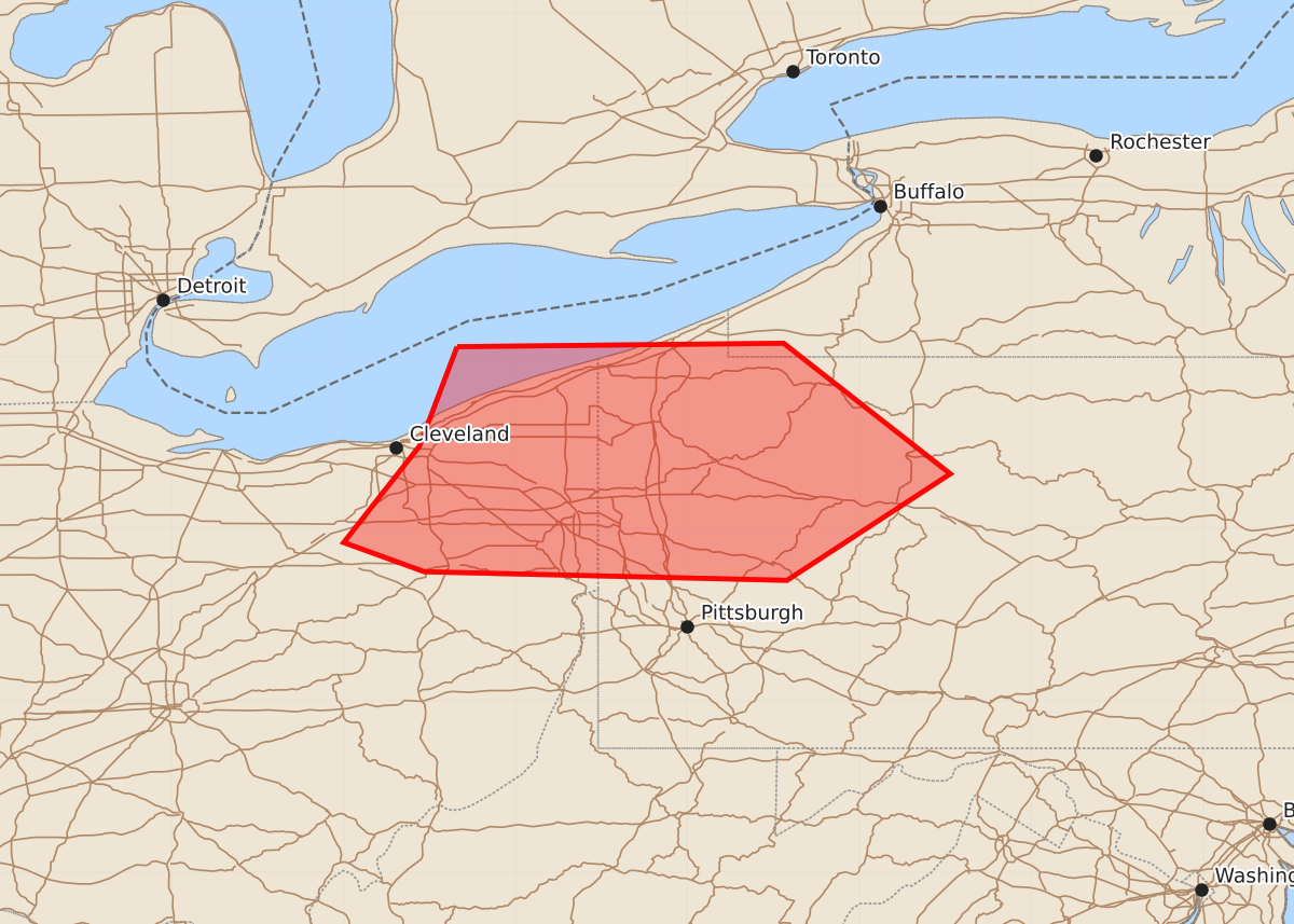
Summary
Small to marginally severe hail and gusty winds may impact the I-80 corridor from northeastern Ohio into northwestern Pennsylvania between 10 AM and noon EDT. Expected hazards include wind gusts up to 70 mph and hail up to 1.25 inches.
Product Text
000 ACUS11 KWNS 101241 SWOMCD SPC MCD 101241 PAZ000-NYZ000-OHZ000-101445- Mesoscale Discussion 1892 NWS Storm Prediction Center Norman OK 0741 AM CDT Mon Aug 10 2026 Areas affected...parts of northeastern Ohio into northwestern Pennsylvania Concerning...Severe potential...Watch possible Valid 101241Z - 101445Z Probability of Watch Issuance...40 percent SUMMARY...A small organizing cluster may impact the I-80 corridor of northeastern Ohio into northwestern Pennsylvania through 10 AM to noon EDT, accompanied by small to marginally severe hail and gusty winds. It is not clear that a severe weather watch is needed in the near term, but potential for stronger, more damaging gusts could increase later this morning, and trends are being monitored. DISCUSSION...A meso-beta scale cyclonic circulation has become better defined within a cluster of storms at least initially rooted above a shallow stable boundary layer. Strong convection has become focused in a short narrow corridor to the east/southeast of this circulation, which is approaching the Greater Cleveland vicinity. Based on recent acceleration in forward (eastward) propagation in excess of 30 kt, the convective system appears likely to track across the I-80 corridor into northwestern Pennsylvania between Franklin and Du Bois by 14-16Z. However, the boundary-layer across this region remains relatively stable, and this may only gradually begin to destabilize over the next few hours. Westerly ambient mean flow in the lower to mid-troposphere also remains relatively modest, on the order of 20-30 kt, so the extent to which potentially damaging wind gusts increases in the near term remains unclear. ..Kerr/Smith.. 08/10/2026 ...Please see www.spc.noaa.gov for graphic product... ATTN...WFO...BUF...CTP...PBZ...CLE... LAT...LON 42068134 42087944 41327847 40707942 40758153 40928200 41488156 42068134 MOST PROBABLE PEAK WIND GUST...55-70 MPH MOST PROBABLE PEAK HAIL SIZE...UP TO 1.25 IN