Mesoscale Discussion 1471
Issued: · Valid: –
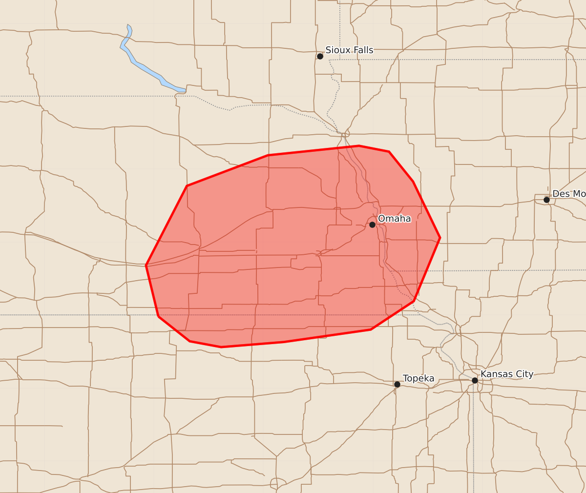
Summary
Severe thunderstorms capable of producing large hail and damaging wind gusts are expected late this afternoon and evening across portions of southeast Nebraska, southwest Iowa, and northeast Kansas. Potential hazards include hail up to 2.5 inches and wind gusts reaching 80 mph.
Product Text
000 ACUS11 KWNS 031953 SWOMCD SPC MCD 031952 IAZ000-MOZ000-NEZ000-KSZ000-032145- Mesoscale Discussion 1471 NWS Storm Prediction Center Norman OK 0252 PM CDT Fri Jul 03 2026 Areas affected...portions of southeast Nebraska into southwest Iowa and far northeast Kansas Concerning...Severe potential...Watch likely Valid 031952Z - 032145Z Probability of Watch Issuance...80 percent SUMMARY...Severe thunderstorm potential is increasing across the mid-MO Valley vicinity. Storm development is possible by 22-23z. Large hail to 2.5 inches and damaging gusts to 80 mph will be the main hazards with storms late this afternoon and evening. A severe thunderstorm watch will likely be needed in the next couple hours. DISCUSSION...Strong destabilization is occurring across southeast NE and vicinity near modifying outflow from prior convection. A swath of midlevel cumulus has developed over the past 1-2 hours. This indicates steep lapse rates and ample instability amid increasing ascent atop weakening MLCIN. An 18z RAOB from OAX showed nearly 4000 J/kg MUCAPE with supercell wind profiles already present. Once capping erodes, isolated to scattered thunderstorm development will likely quickly occur. Initial supercells will pose a risk of very large hail to near baseball size. Given large instability, damaging gusts are also possible. The risk for severe gusts may increase during the evening if upscale development occurs via sufficient storm clustering and outflow consolidation. While convective initiation timing remains a bit uncertain, it appears a severe thunderstorm watch will likely be needed in the next 1-2 hours. ..Leitman/Hart.. 07/03/2026 ...Please see www.spc.noaa.gov for graphic product... ATTN...WFO...DMX...EAX...FSD...OAX...TOP...GID...LBF... LAT...LON 39989894 40689911 41779855 42199744 42329619 42249578 41839545 41069508 40199544 39809603 39639722 39569808 39649851 39989894 MOST PROBABLE PEAK TORNADO INTENSITY...UP TO 90 MPH MOST PROBABLE PEAK WIND GUST...65-80 MPH MOST PROBABLE PEAK HAIL SIZE...1.50-2.50 IN