Day 1 Convective Outlook
This product has been superseded. View the updated product →
Issued: · Valid: –
Summary
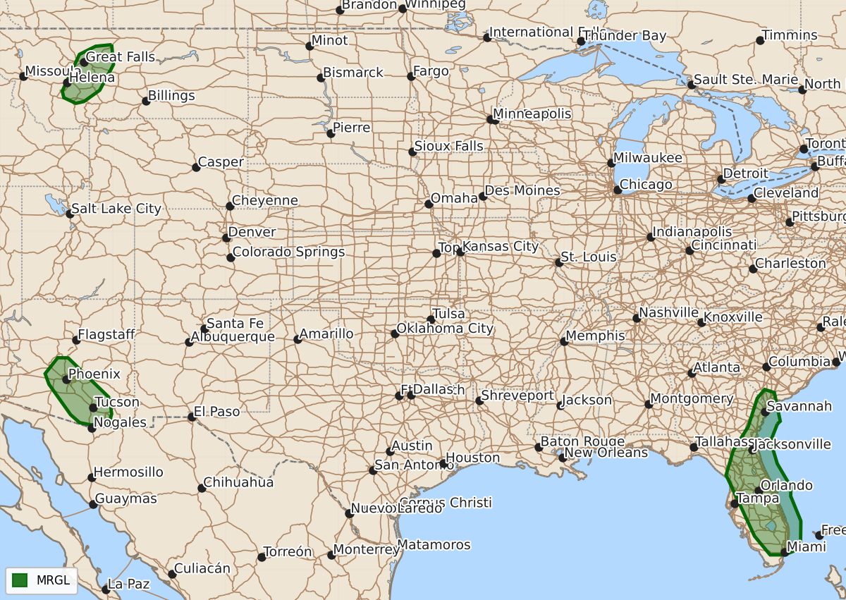
Scattered thunderstorms capable of producing gusty or damaging winds are expected this afternoon and evening across parts of the Southeast, Arizona, and Montana.
Product Text
000 ACUS01 KWNS 131602 SWODY1 SPC AC 131601 Day 1 Convective Outlook NWS Storm Prediction Center Norman OK 1101 AM CDT Mon Jul 13 2026 Valid 131630Z - 141200Z ...THERE IS A MARGINAL RISK OF SEVERE THUNDERSTORMS OVER PARTS OF THE SOUTHEAST COAST...AND PORTIONS OF ARIZONA.... ...SUMMARY... Thunderstorms with isolated strong to severe winds may occur this afternoon and evening across parts of the Southeast and Montana. An expansive upper ridge over the northern Plains will dominate the weather across the US today, with only small areas of risk of severe storms. ...FL/GA... A hot and humid air mass is present today over the FL Peninsula into parts of southeast GA/SC. Scattered afternoon thunderstorms are expected to form in this regime, with the strongest cells capable of gusty/damaging winds. ...AZ... Widespread convection yesterday has resulted in a moist boundary layer across southern AZ, where strong heating will occur again today. This will lead to another round of scattered storms moving off the higher terrain of eastern AZ and speading westward into the Deserts. A few of the storms may produce gusty/damaging winds. ...MT... Morning CAM solutions are consistent on the forecast of a cluster of high-based thunderstorms forming over the mountains of southern MT and tracking north-northeastward during the evening. Forecast soundings would support some risk of a gusty/damaging winds in these storms. ..Hart/Barnes.. 07/13/2026 $$