Mesoscale Discussion 1396
Issued: · Valid: –
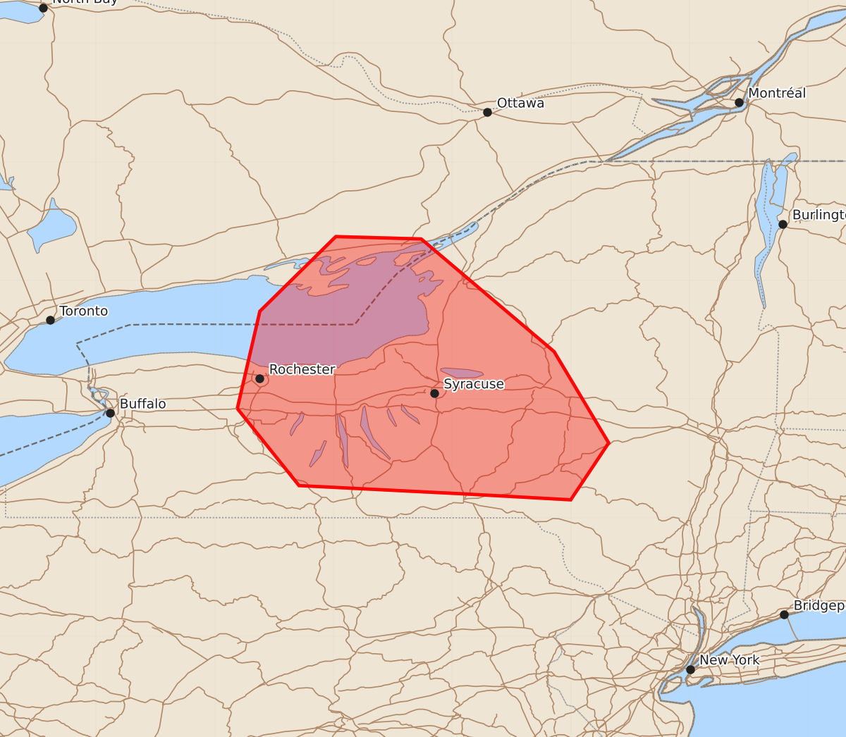
Summary
Central New York may experience damaging wind gusts of 60-70 mph, large hail, and brief tornadoes this afternoon.
Product Text
000 ACUS11 KWNS 301624 SWOMCD SPC MCD 301623 NYZ000-301830- Mesoscale Discussion 1396 NWS Storm Prediction Center Norman OK 1123 AM CDT Tue Jun 30 2026 Areas affected...Central New York Concerning...Severe potential...Watch likely Valid 301623Z - 301830Z Probability of Watch Issuance...80 percent SUMMARY...Damaging wind potential is expected to increase this afternoon with gusts of 60-70 mph possible. Isolated occurrences of large hail and perhaps a brief tornado or two may also occur. DISCUSSION...Volumetric radar data from KTYX indicate a bow echo with a well-defined rear-inflow jet moving southeast at around 50 kt. Extrapolation of current motion takes the bow echo to the vicinity of Watertown, NY, between 1:00-1:30 PM EDT. Visible satellite imagery shows considerable mid/upper-level cloudiness and some elevated convection ahead of the MCS across the Tug Hill region; however, stronger heating is occurring across the Finger Lakes and far western NY with latest objective analysis indicating MLCAPE of 1500-2500 J/kg. Persistent westerly low-level flow will advect that more unstable air mass into the region ahead of the MCS. The current KTYX VWP indicates a vertically wind profile with 40-50 kt of northwesterly flow above 4-5 km, yielding sufficient vertical shear for the continuation of the bow echo into central NY this afternoon. Damaging winds will be the primary hazard with gusts of 60-70 mph possible. Some large hail is possible along the western flank of the system, which will be exposed to an EML plume spreading into the region from the upper Great Lakes. Additionally, the presence of modest low-level shear may support the potential for a brief tornado or two in association with embedded mesovortices. ..Mead/Guyer.. 06/30/2026 ...Please see www.spc.noaa.gov for graphic product... ATTN...WFO...ALY...BGM...BUF... LAT...LON 42927781 43747762 44377698 44357626 43407514 42637468 42157500 42207590 42277729 42927781 MOST PROBABLE PEAK TORNADO INTENSITY...UP TO 90 MPH MOST PROBABLE PEAK WIND GUST...55-70 MPH MOST PROBABLE PEAK HAIL SIZE...UP TO 1.25 IN