Mesoscale Discussion 1968
Issued: · Valid: –
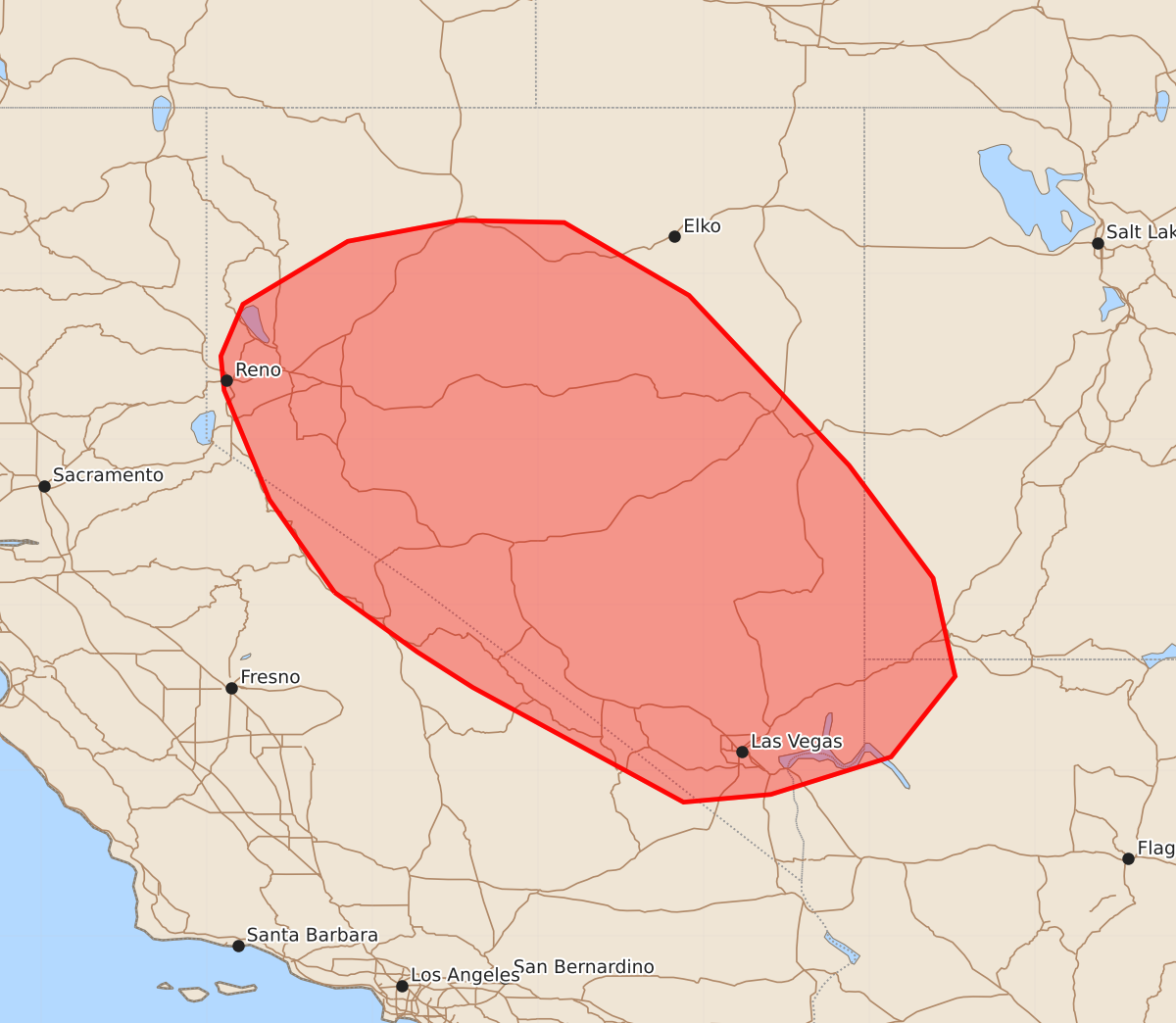
Summary
Scattered to numerous thunderstorms will bring a risk of isolated damaging wind gusts and small hail to portions of the Great Basin through this evening.
Product Text
000 ACUS11 KWNS 131925 SWOMCD SPC MCD 131924 UTZ000-AZZ000-NVZ000-CAZ000-132130- Mesoscale Discussion 1968 NWS Storm Prediction Center Norman OK 0224 PM CDT Thu Aug 13 2026 Areas affected...portions of the Great Basin Concerning...Severe potential...Watch unlikely Valid 131924Z - 132130Z Probability of Watch Issuance...20 percent SUMMARY...Scattered to numerous thunderstorms will bring a risk for isolated damaging/severe wind gusts and perhaps an instance or two of marginally severe hail to portions of the Great Basin through this evening. DISCUSSION...Aided by ascent ahead of an upper-level trough centered over California, thunderstorm development is ongoing across portions of central and southern Nevada and along the Sierra Nevada Mountains in eastern California. Strong diurnal heating, modestly cool temperatures aloft, and surface dewpoints around 50 F are supporting weak buoyancy, with 500-1000 J/kg MLCAPE depicted by latest objective analysis and the 18 UTC VEF observed sounding. As thunderstorms evolve northeastward through this evening, steepening low-level lapse rates and increasingly well-mixed boundary layer profiles will promote evaporatively cooled downdrafts and cold pool formation. In conjunction with modest effective shear of 20-25 kts, this is expected to result in loosely organized convective clusters and an isolated risk for damaging/severe wind gusts. An instance or two of marginally severe hail also cannot be ruled out with the most robust updrafts. Given the expectation for the severe risk to remain limited in magnitude, watch issuance appears unlikely at this time. ..Chalmers/Guyer.. 08/13/2026 ...Please see www.spc.noaa.gov for graphic product... ATTN...WFO...SLC...VEF...LKN...REV... LAT...LON 37611884 38451943 39441984 39751987 40221967 40791872 40981771 40961676 40301563 38761418 37741342 36851322 36121380 35781489 35711568 36751759 37071809 37611884 MOST PROBABLE PEAK WIND GUST...55-70 MPH MOST PROBABLE PEAK HAIL SIZE...UP TO 1.25 IN