Mesoscale Discussion 1616
Issued: · Valid: –
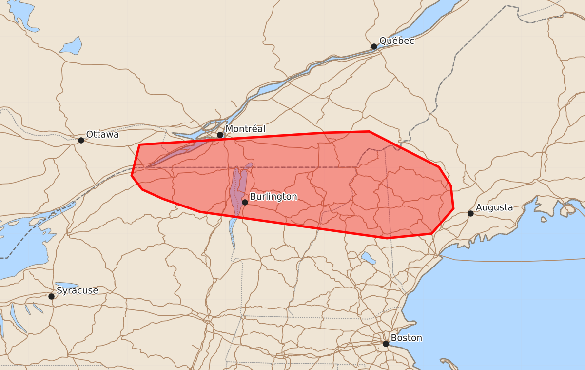
Summary
Severe thunderstorms with the potential for tornadoes, large hail, and damaging winds may develop across portions of northern New York, Vermont, New Hampshire, and southwest Maine through this evening. These storms could manifest as organized clusters or supercells depending on local atmospheric conditions.
Product Text
000 ACUS11 KWNS 142254 SWOMCD SPC MCD 142253 MEZ000-NHZ000-VTZ000-NYZ000-150100- Mesoscale Discussion 1616 NWS Storm Prediction Center Norman OK 0553 PM CDT Tue Jul 14 2026 Areas affected...portions of northern New York...Vermont...New Hampshire and southwest Maine Concerning...Severe potential...Watch possible Valid 142253Z - 150100Z Probability of Watch Issuance...40 percent SUMMARY...Severe potential remains evident over parts of New England through this evening, both with ongoing storms and new convective development in southern Quebec. The need for a watch is unclear, but trends are being watched closely. DISCUSSION...As of 2250 UTC, regional visible and radar imagery showed a cluster of thunderstorms in northern NH and southwest ME have remained generally weak. Widespread wildfire smoke and cloud debris has limited diurnal heating, resulting in lingering inhibition evident from terrain-induced stable billow clouds over portions of southern New England. However, just to the south of the primary baroclinic zone, a much warmer air mass remains relatively undisturbed this evening. With MLCAPE of 2000-3000 J/kg and ample vertical shear, intensification of the ongoing storms remains possible if they are able to access the more unstable air mass. A mix of organized clusters and supercells would present some risk for all hazards. Meanwhile, a second cluster of storms is evident over portions of southern QC, along with more agitated boundary-layer cumulus near the international border. HRRR guidance continues to show some intensification/additional development with this cluster through this evening. This is plausible given the proximity to the warmer and more unstable air mass along and southeast of the St Lawrence Valley. The approach of the upper trough and strong mid-level jet (70+ kt) may also provide enough ascent to overcome the remaining inhibition in the next couple of hours. However, confidence in the convective evolution remains very low. All hazards would be possible if this cluster, or any new development can intensify. The environment remains conditionally supportive of organized clusters and supercells with significant severe potential. Convective trends are being closely monitored, but the need for a WW remains unclear. ..Lyons/Smith.. 07/14/2026 ...Please see www.spc.noaa.gov for graphic product... ATTN...WFO...GYX...BTV... LAT...LON 45357481 45537201 45557132 45017026 44737008 44387004 44007037 43937105 44337389 44537446 44677477 44887493 45357481 MOST PROBABLE PEAK TORNADO INTENSITY...100-125 MPH MOST PROBABLE PEAK WIND GUST...55-70 MPH MOST PROBABLE PEAK HAIL SIZE...1.50-2.50 IN