Mesoscale Discussion 1544
Issued: · Valid: –
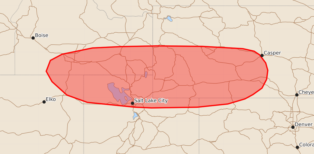
Summary
Isolated severe thunderstorms capable of producing damaging wind gusts may affect portions of the northern Great Basin through this evening. These storms are expected to bring wind gusts between 55 and 70 mph.
Product Text
000 ACUS11 KWNS 081959 SWOMCD SPC MCD 081959 WYZ000-COZ000-UTZ000-IDZ000-NVZ000-082200- Mesoscale Discussion 1544 NWS Storm Prediction Center Norman OK 0259 PM CDT Wed Jul 08 2026 Areas affected...portions of the northern Great Basin Concerning...Severe potential...Watch unlikely Valid 081959Z - 082200Z Probability of Watch Issuance...20 percent SUMMARY...Strong to occasionally severe thunderstorms will pose a risk for isolated damaging/severe wind gusts through this evening. Watch issuance is unlikely at this time. DISCUSSION...Isolated to widely scattered convection has developed across portions of the northern Great Basin as of 1950 UTC. A modified 18z SLC sounding depicts minimal remaining inhibition, with a deep, well-mixed boundary layer and weak buoyancy (200-500 J/kg MLCAPE) in place. As continued insolation results in additional thunderstorm development through the afternoon, steep low-level lapse rates and high LCLs (2500-3000+ m) will promote the potential for isolated damaging/severe wind gusts. Modest effective shear (~20 kts or less) and weak deep-layer flow (generally 25 kts or less sampled by the SFX/MTX/RIW VWPs) should largely limit storm organization and temper the overall severe threat. While a corridor or two of locally greater severe potential may manifest where storms cluster along developing cold pools, the severe risk is expected to remain too isolated for watch issuance at this time. ..Chalmers/Hart.. 07/08/2026 ...Please see www.spc.noaa.gov for graphic product... ATTN...WFO...CYS...RIW...GJT...SLC...PIH...BOI...LKN... LAT...LON 41810612 41430632 41150671 40960706 40740780 40600913 40571110 40601181 40811388 41131477 41711541 42161566 42631548 42901497 43171366 43231243 43261086 43240892 43140715 43030666 42870642 42520616 42200607 41810612 MOST PROBABLE PEAK WIND GUST...55-70 MPH