Mesoscale Discussion 1802
Issued: · Valid: –
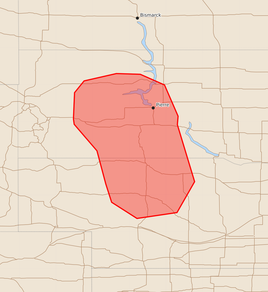
Summary
Severe thunderstorms capable of producing large hail and damaging winds are expected across central South Dakota and northern Nebraska this afternoon. The threat will increase through the evening as storms develop and cluster.
Product Text
000 ACUS11 KWNS 301758 SWOMCD SPC MCD 301757 NEZ000-SDZ000-302000- Mesoscale Discussion 1802 NWS Storm Prediction Center Norman OK 1257 PM CDT Thu Jul 30 2026 Areas affected...central South Dakota into northern Nebraska Concerning...Severe potential...Severe Thunderstorm Watch likely Valid 301757Z - 302000Z Probability of Watch Issuance...80 percent SUMMARY...Supercells to increase with potential for large hail and damaging wind. DISCUSSION...Thunderstorm development is underway across central South Dakota near a region of increasing mid-level ascent over spreading the central/northern Plains. Behind morning convection, clearing cloud cover has allowed for modest heating with temperatures in the 80s F and dewpoints in the upper 60s to 70s F. This has yielded MLCAPE around 1000-2000 J/kg. Deep layer shear around 20-30 kts and veering wind profiles will support supercell modes and potential for large hail and damaging wind initially. Through time, guidance suggests that clustering will occur with increasing potential for damaging wind into the evening. A watch will likely be needed this afternoon to address these potential threats. ..Thornton/Mosier.. 07/30/2026 ...Please see www.spc.noaa.gov for graphic product... ATTN...WFO...FSD...ABR...LBF...UNR... LAT...LON 42300164 43200188 43920250 44070252 44780249 45100223 45300135 45280070 44990004 44149967 43919969 42369922 41529970 41360079 41800148 42300164 MOST PROBABLE PEAK TORNADO INTENSITY...UP TO 90 MPH MOST PROBABLE PEAK WIND GUST...55-70 MPH MOST PROBABLE PEAK HAIL SIZE...UP TO 1.25 IN